Wayfinding System Redesign of Chung Hsing Cultural & Creative Park
![]()
中興文創園區營運至今,舊有指標已不符合實際需求。團隊實地造訪後,搜集民眾及業者意見、製作現況調查與動線分析,從而著手系統更新設計。
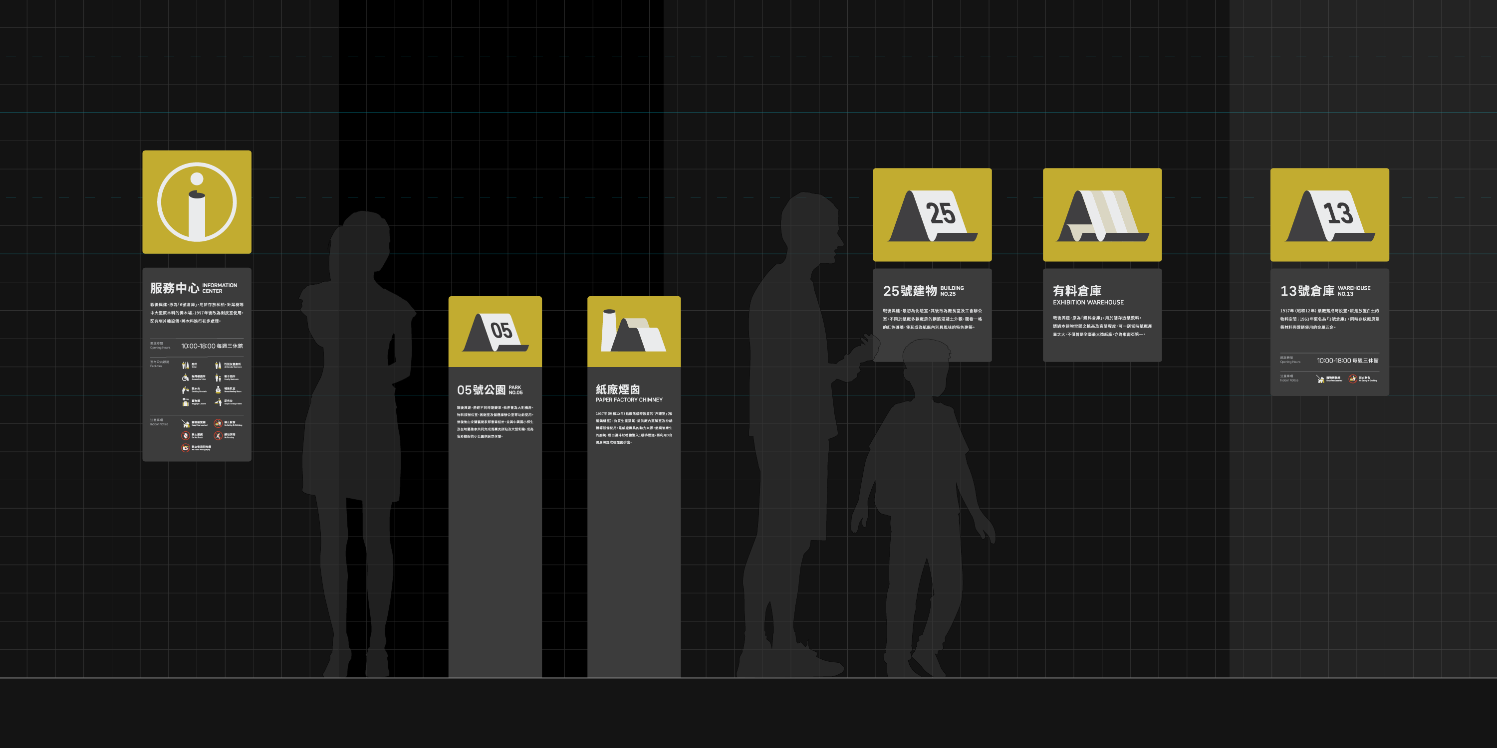
更新後的視覺焦點回歸「紙廠」的歷史脈絡,圖標融入紙張彎折、捲曲意象;色彩與字體也因應工業遺構景色進行搭配,並重新規劃建築名稱系統與資訊陳列層級。
WAYFINDING SYSTEM DESIGN
CLIENT/
Chung Hsing Cultural & Creative Park, Cultural Affairs Bureau Yilan County
The redesigned wayfinding system for “CHCC Park” returns its focus to the site’s historical context of "former paper factory", while considering the present scenery of industrial relics.
By incorporating the imagery of paper being bent or folded, a unique visual vocabulary was established to present a distinct identity suited for navigation purposes and future expansions.
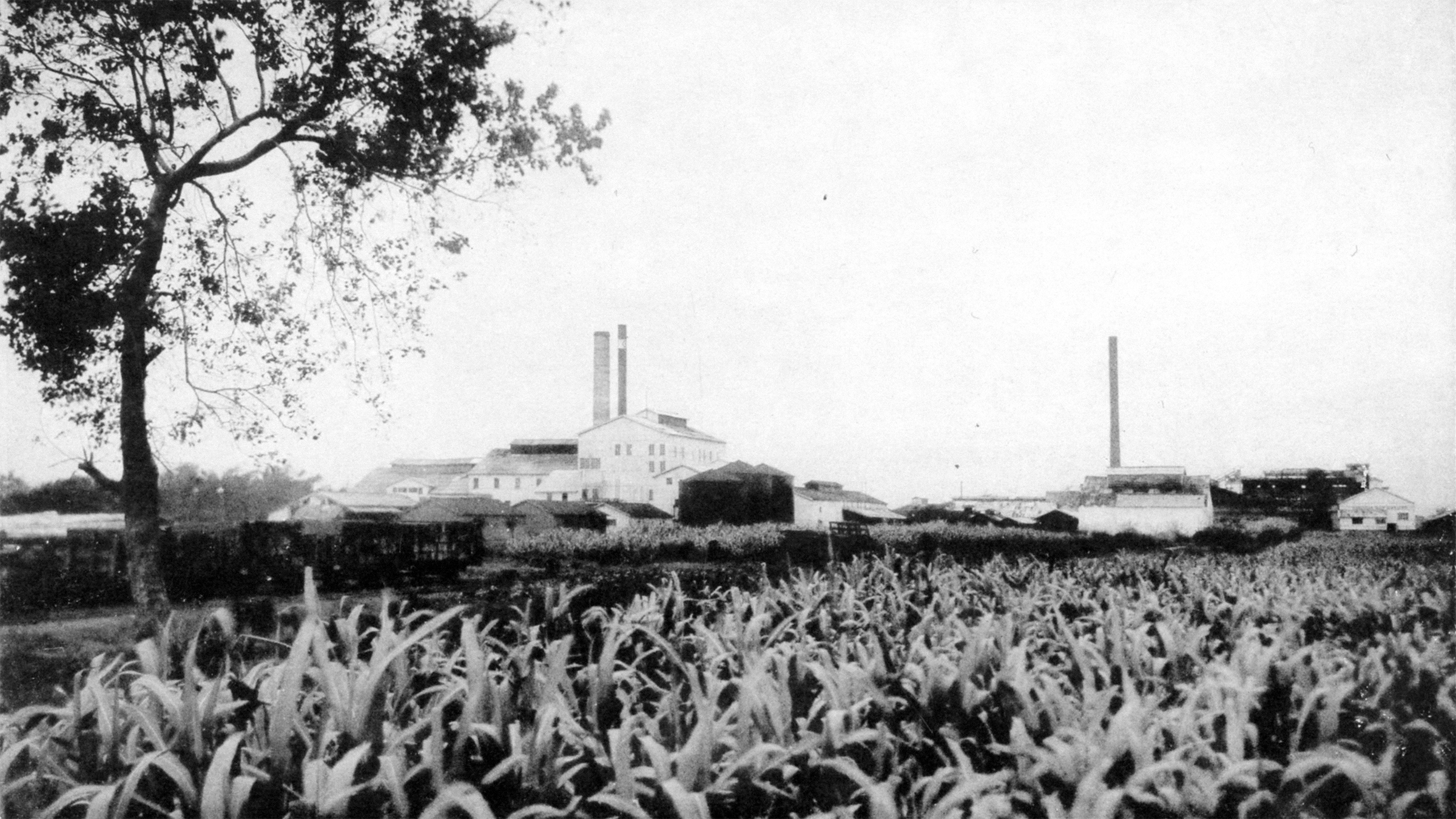
「中興文化創意園區」前身可回溯至昭和10年(西元1935年)成立的「臺灣興業株式會社」,後經歷國營事業接管改組為「中興紙廠」。2013年由宜蘭縣政府經手轉型,透過工業遺構的保存與活化,逐步發展成培育及經營地方文創應用的空間。
The predecessor of the Chung Hsing Cultural and Creative Park can be traced back to the Taiwan Industrial Corporation, which was established in 1935. It was later reorganized into a state-owned paper factory. In 2013, the Yilan County Government initiated the preservation and revitalization of industrial heritage within the park. Since then, it has gradually developed into a space for cultivating and operating local cultural and creative applications.
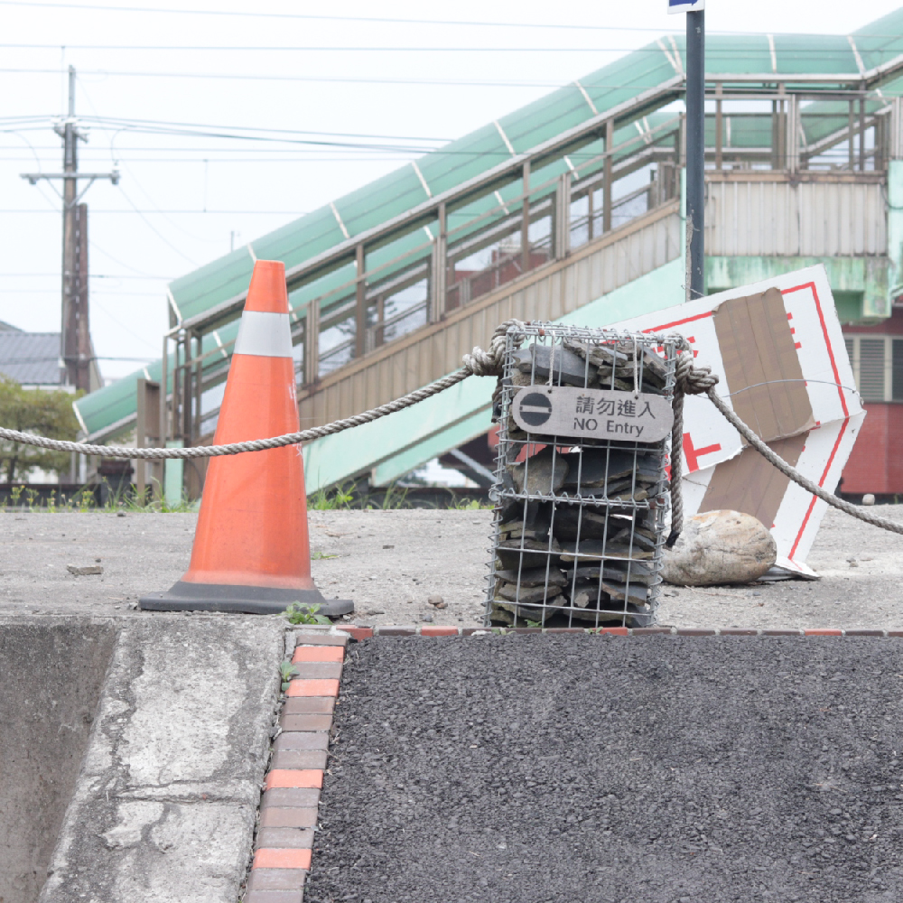
然而園區營運多年以來,並未建立完整的指標系統,在不同階段的建設當中參雜風格各異的設計;且隨著部分設施營運方針改變,一定比例的指標已不再符合實際需求。
為此,園區遂於2023年委託團隊進行指標系統的更新設計及施作,並隨之展開為期一年的工作計劃。
However, after years of operation, no complete wayfinding system was established among the park. Designs with mixed styles had been implemented between different stages of construction, and as operating policies of some facilities had changed, a certain proportion of signages no longer meet actual needs.
Thus in 2023, the park commissioned us to carry out a one-year work plan, aiming to update the overall wayfinding system.
工作計劃
System Update Planning
團隊從實地造訪開始,搜集了參觀民眾及進駐業者的意見,並製作指標現況調查、基礎設施統計、入園動線分析等前置準備。
在盤點完畢園區既有和未來階段的各類需求後,著手進入設計作業。
We started with a field visit, collected opinions from visitors, and organized meetings with businesses. Space studies were also conducted, laying out visitor flows and decision points, gathering all information needed for our design process.


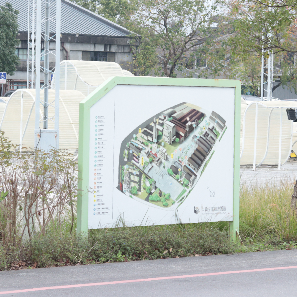
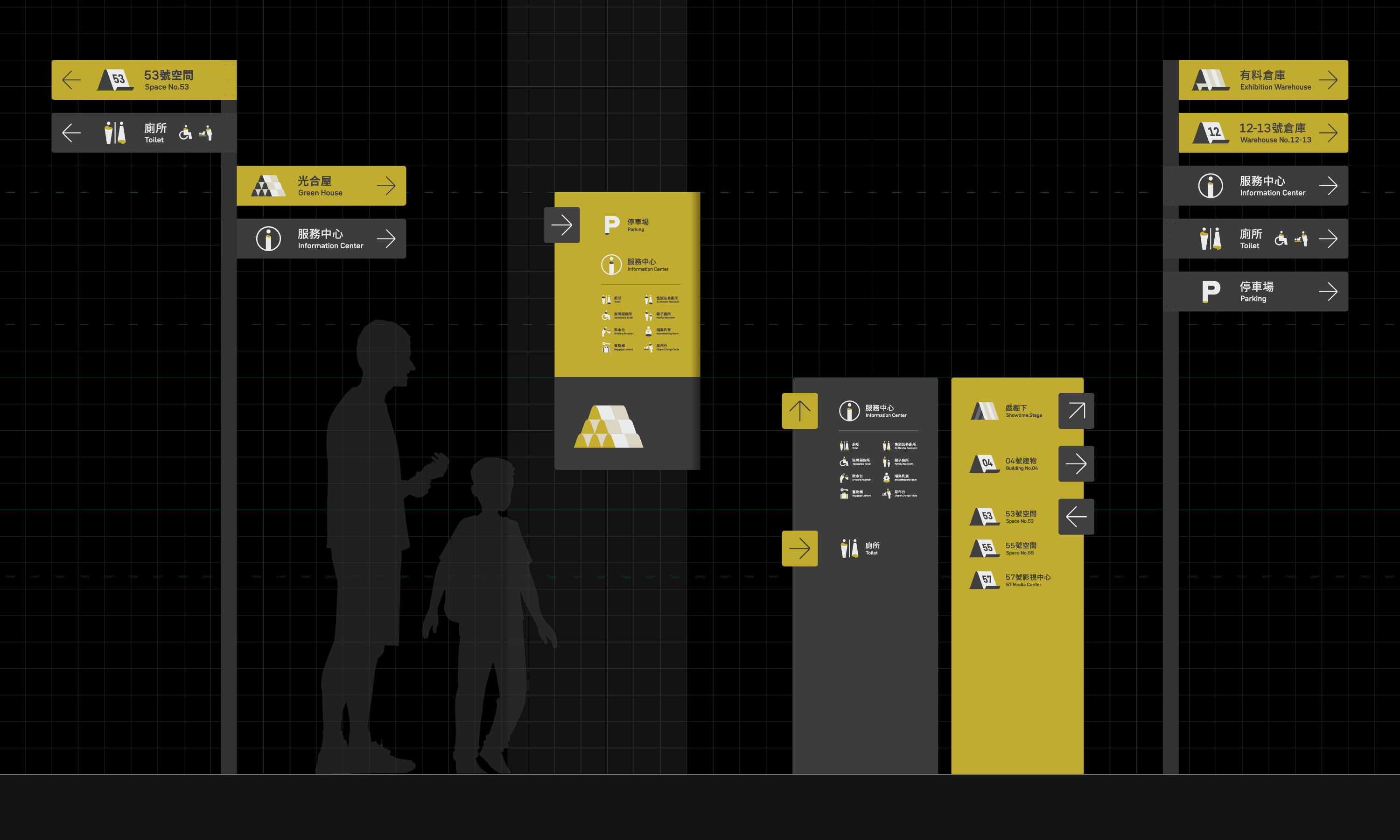
指標更新前後佈局 Wayfinding Updates
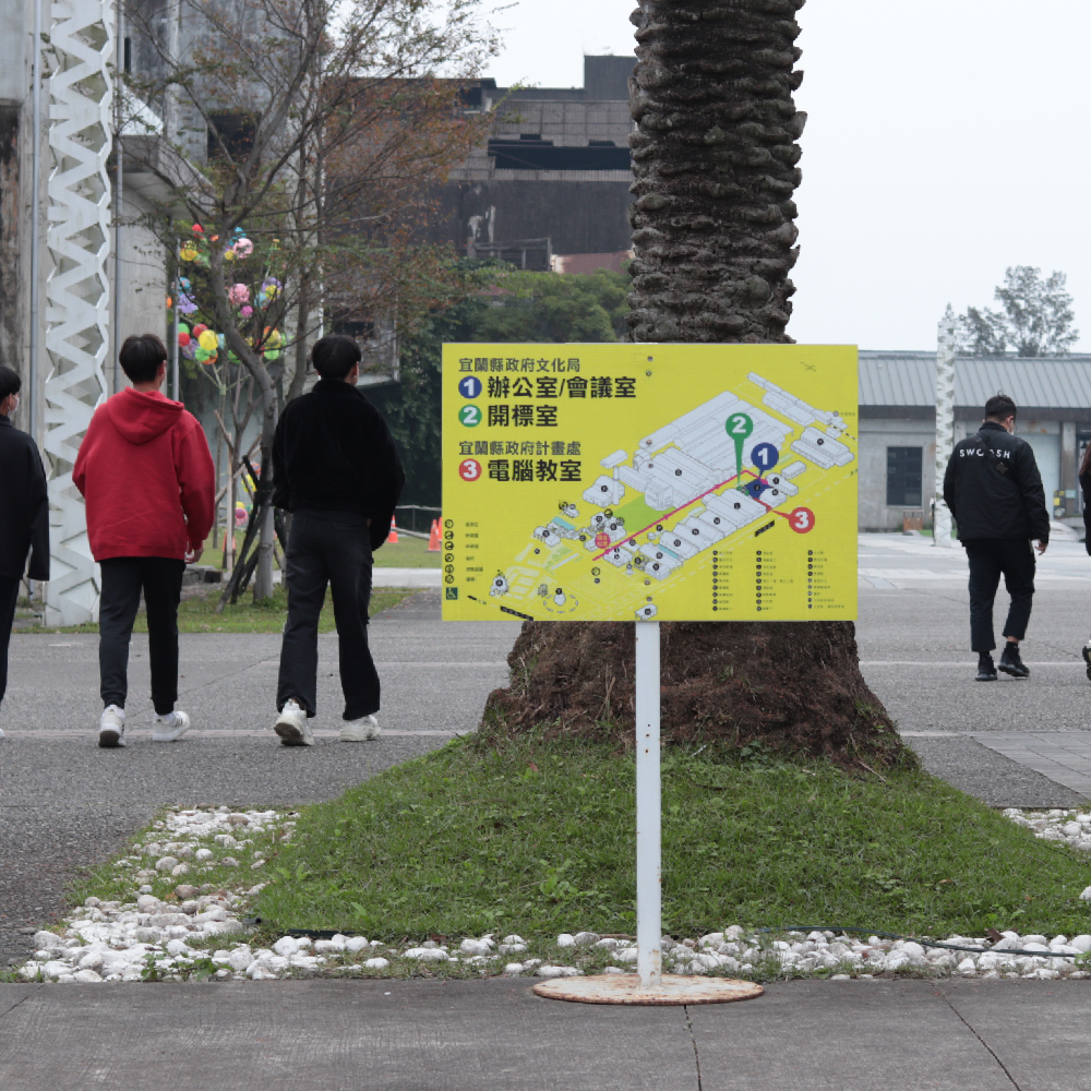
鑑於園區腹地廣大、服務設施及開放空間分佈距離較遠,指標系統如何與民眾入園的習慣動線產生重疊、進而達到引導效果,是我們在規劃時的重要考量。
藉由導入「節點」與「指標層級」的系統,我們得以更清晰掌握設計時所需擺放的位置,以及承載的關鍵資訊。
Given that the park has a vast space and facilities are scattered over long distances, ensuring the wayfinding system overlaps with the habitual routes of visitors and thus achieves a guiding effect is an crucial point in our planning.
By introducing "decision points" and creating a variety of levels in our system, we are able to get a better grasp of where our design placements should be, and what key information they must carry.
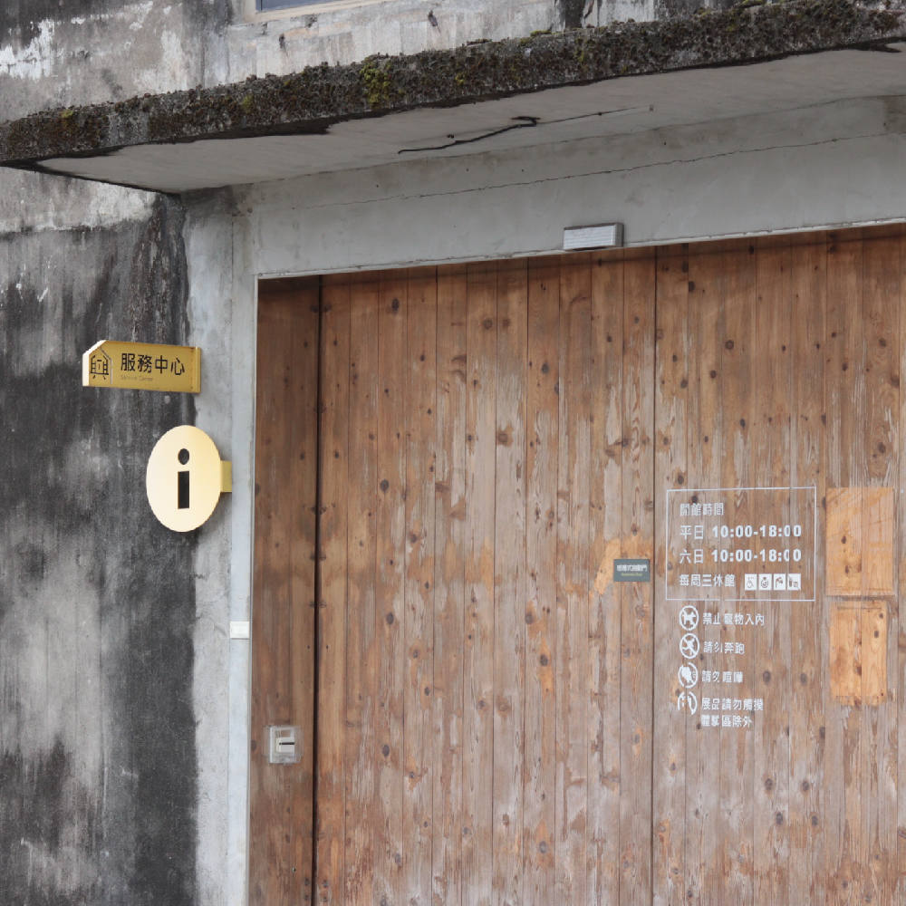
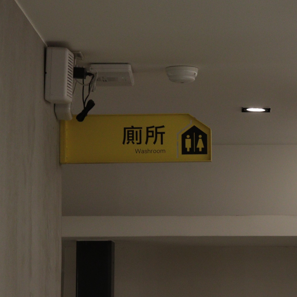
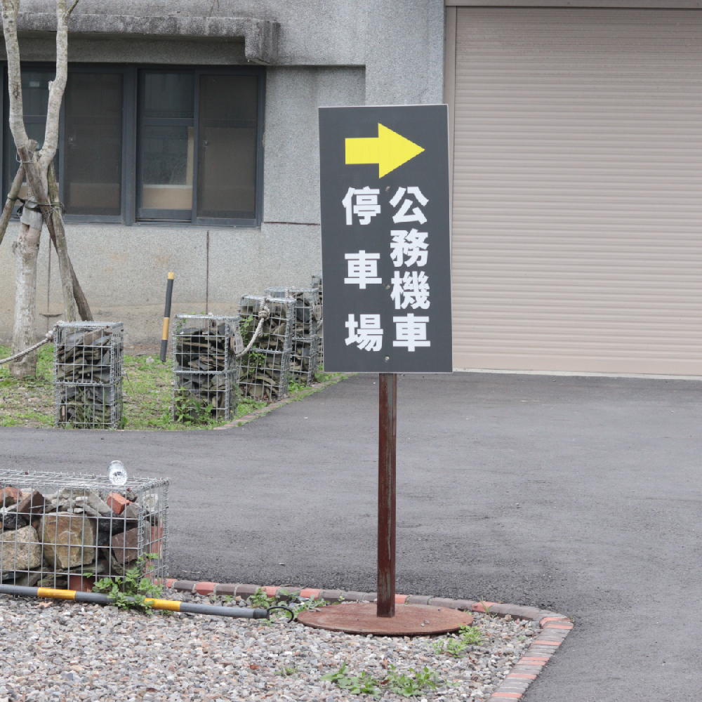
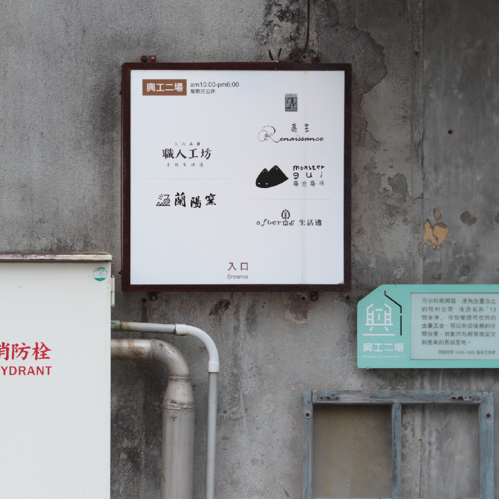
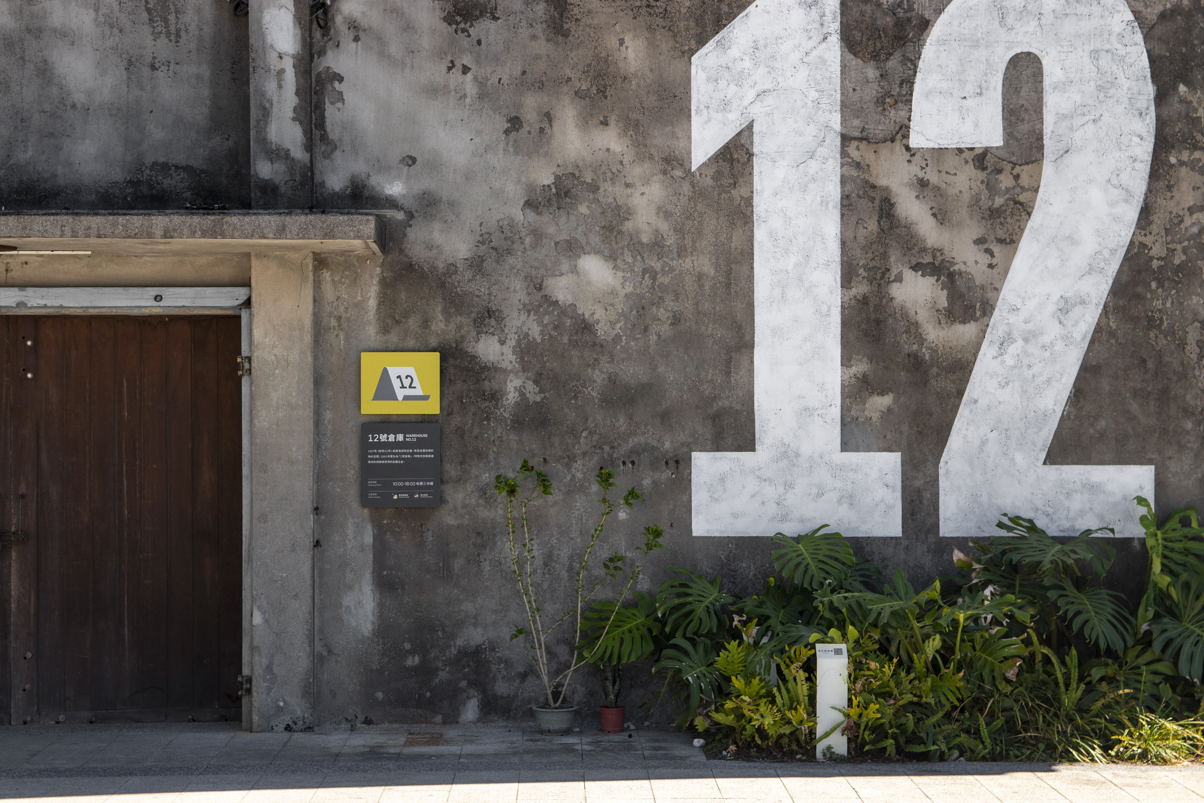
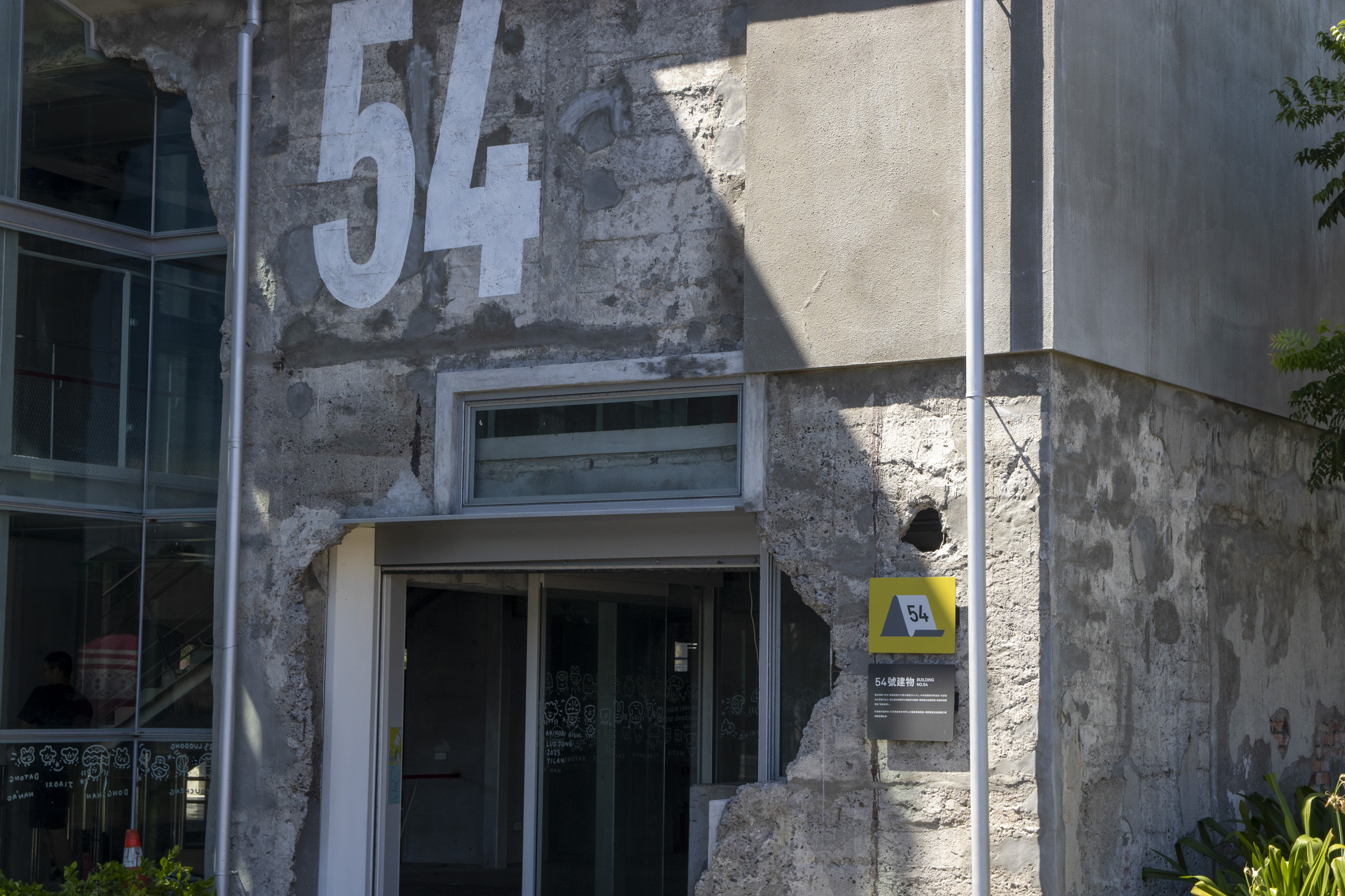
指標的層級呈現也是影響視導的重要因素之一。整體系統中,我們由大至小規劃出不同引導效果的形式;從建築牆面上的大型數字引導、圖標內的編號標示,到基礎的牌面排版中,如何配合大眾民眾閱讀習慣的同時,維持系統個性及清晰度,都需要經過精心安排。
Different levels presented among the layout of our design is also one of the crucial factors. We created various forms of wafinding elements from large to smaller scales, from numeric titles on the walls, numbered labels in pictograms, to basic signage layout. Efforts were made to maintaining the system's identity and clarity while coordinating with the general public's reading habits.
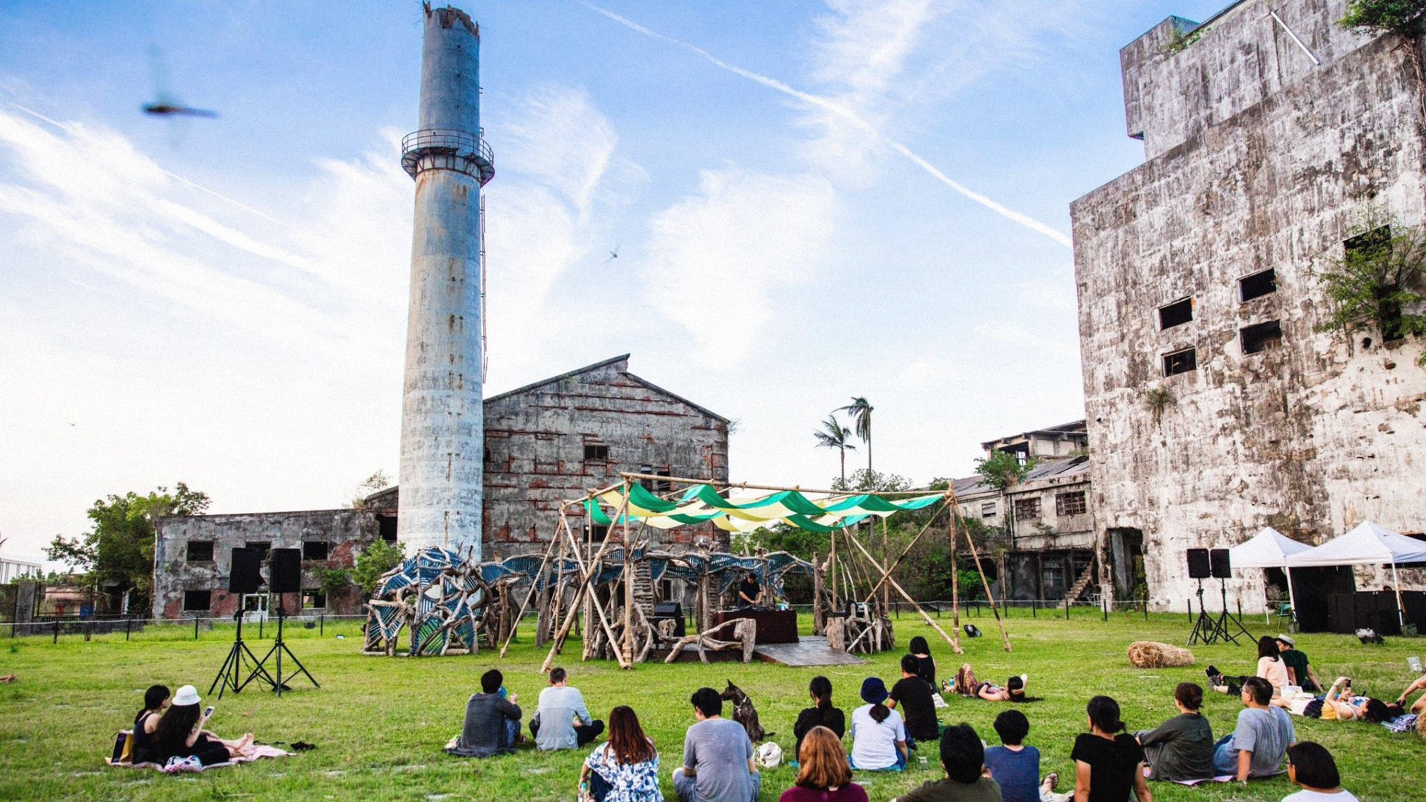
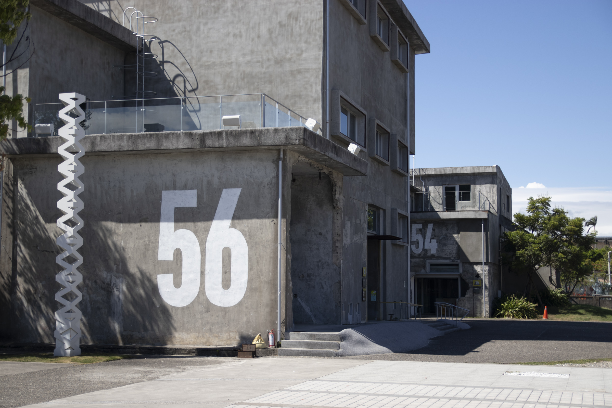
面對園區內結構相似、連貫配置的工業遺構建築群,一般指標尺寸與樣式難以清晰區辨。因此我們導入「牆面大型編號塗繪」的設計策略,提升遠距可辨識性,也強化場域中「紙廠歷史」的連結。
By painting large-scale numeric titles on certain buildings that share similar structures and coherent locations, we improved long-distance clarity and strengthened their past industrial context.