指標設計 Signage Showcase
介紹完前期規劃與系統設計,以下為整體計劃中部分的指標設計說明:
With the preliminary plannings and system setup introduced, the following is some of the signage designs in the overall plan and their description.
![]()
入園地圖 Entrance Map (Main Decision Point)
我們觀察到民眾入園的主要動線為停車場末端、服務中心前通道,故在此處設立乘載完整資訊的全區地圖,詳列各處地標與服務設施,以便民眾快速釐清位置並規劃動線。
We noticed that the main entering route is from the passage in front of the service center, connecting the end of the parking lot. Thus, we set up a map of the entire area with complete information, detailing various landmarks and service facilities, ensuring visitors could identify their location and plan their routes.
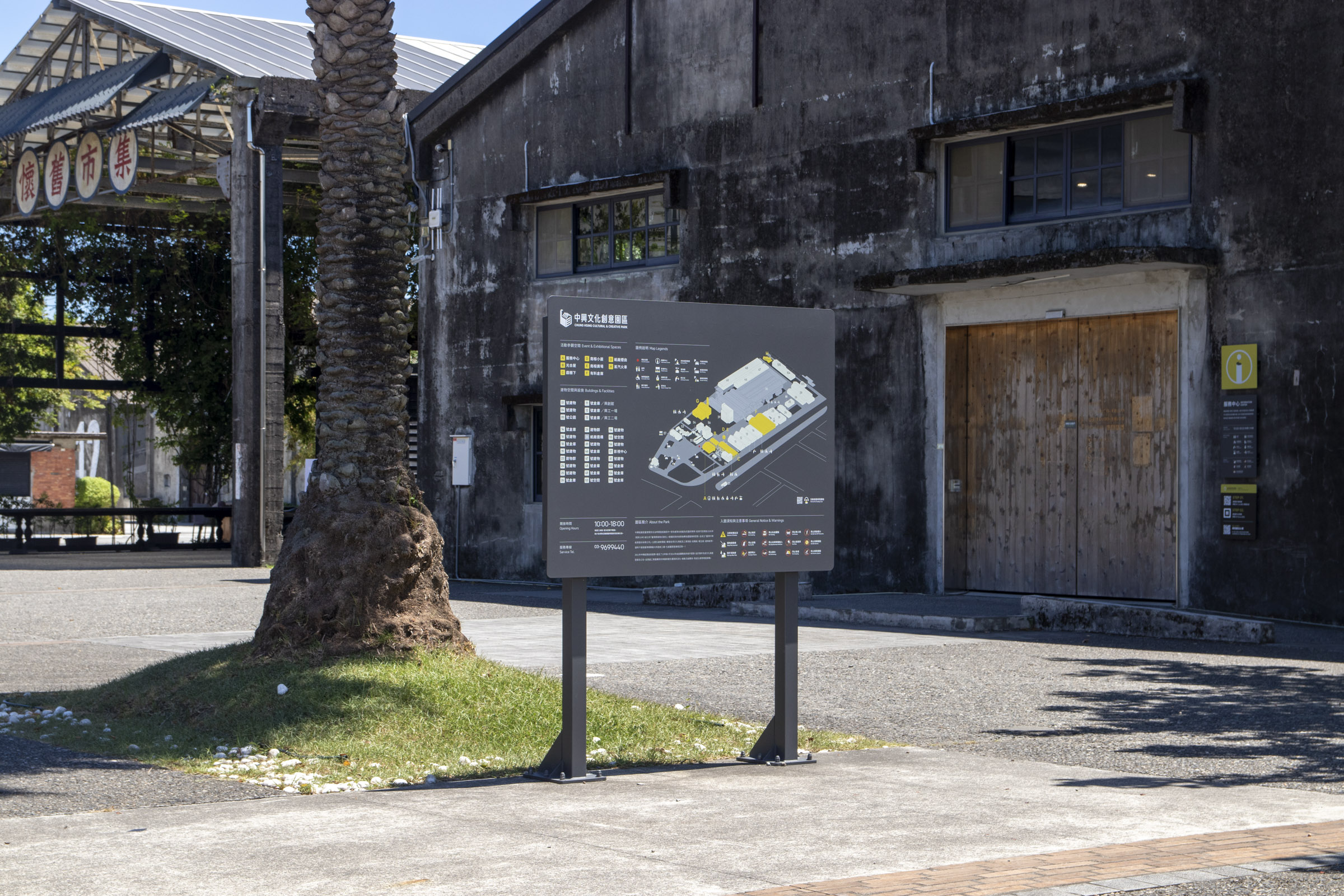
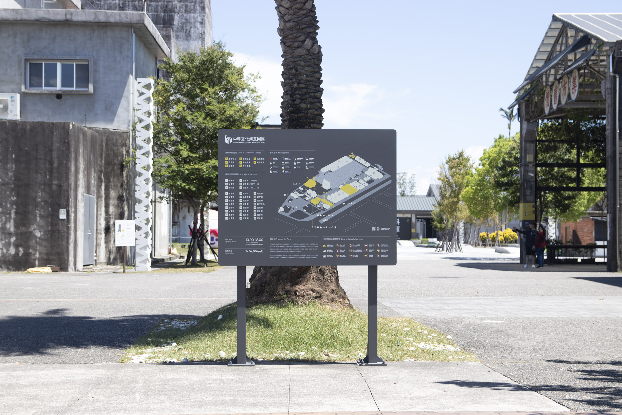
全區地圖 Central Map (Main Decision Point)
園區前後兩段皆有腹地較大的廣場區域,並且都坐落於參訪的主要動線上。鑑於廣場周圍錯落不少服務設施及參觀地標,我們在中央都有設置斜立型態的地圖指標;以便在此作短暫停留的民眾可以規劃下一步動線。
The front and back sections of the park have large plaza areas, both located along the main visiting routes. Considering many facilities and landmarks surround the squares, we set up tilted map signages in both centers. Thus, visitors staying at the square for a short time can plan their next route.
直立式地圖 Vertical Map (Main Decision Point)
實地觀察時我們注意到駕車抵達的民眾習慣先前往服務中心後方的友善廁所盥洗,隨後從周遭通道進入園區。
然而此區域較不容易匯流至主要動線,因此我們設置版面較小的直立型地圖,避免民眾通行時無法有效尋找指引。
During our survey, we noticed that visitors who arrived by car were accustomed to heading for the washroom behind the service center first, then entering the park through surrounding passages.
However, it is rather challenging to converge into the main visiting routes from here; therefore, a smaller vertical map is set up to prevent people from having a hard time finding directions when passing through.
![]()
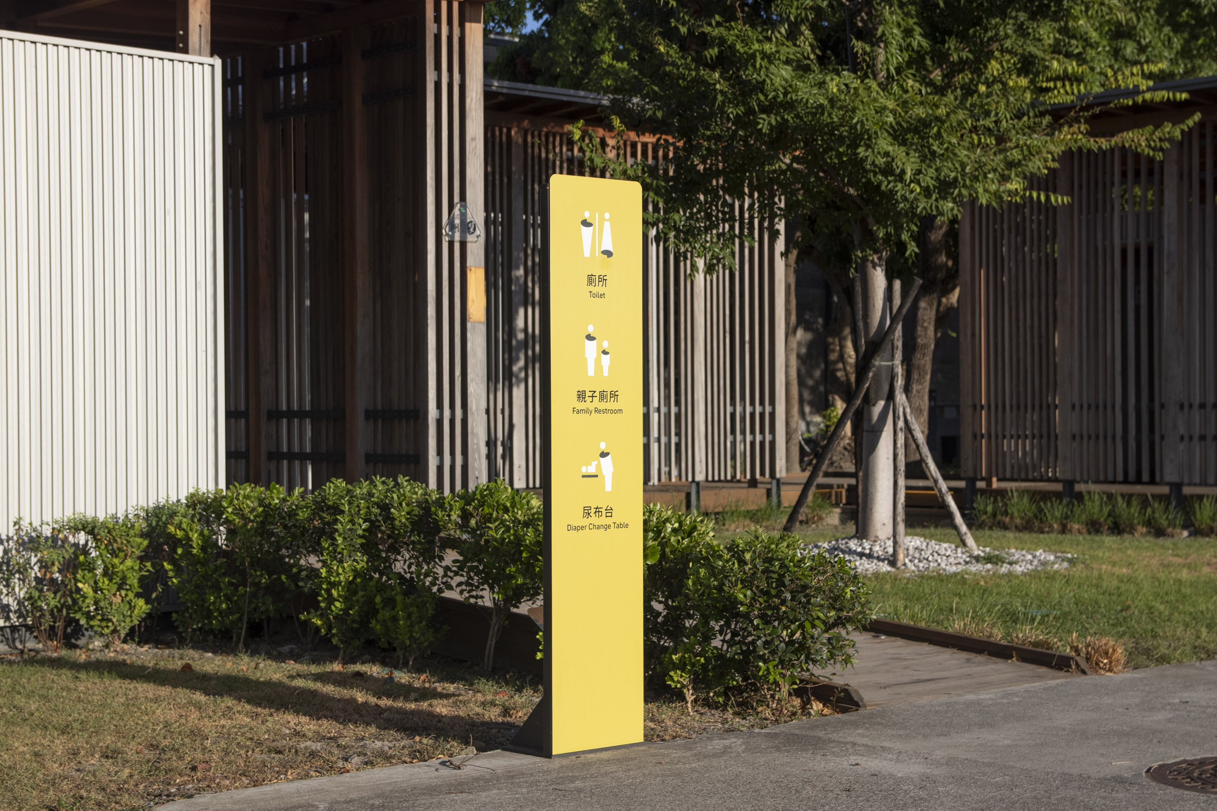
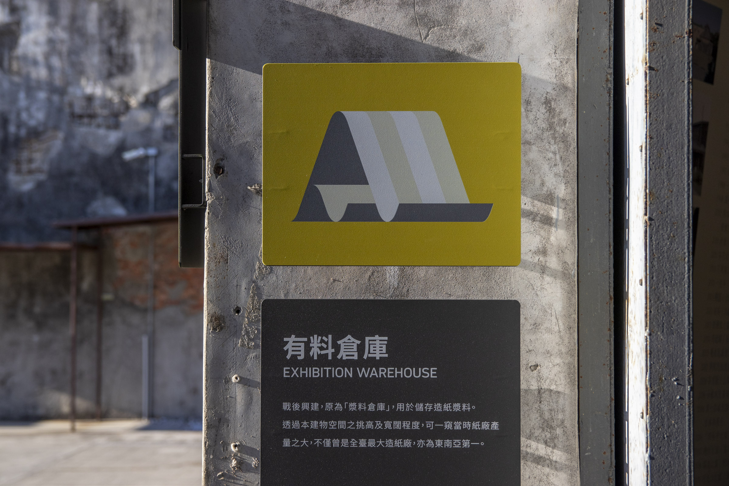
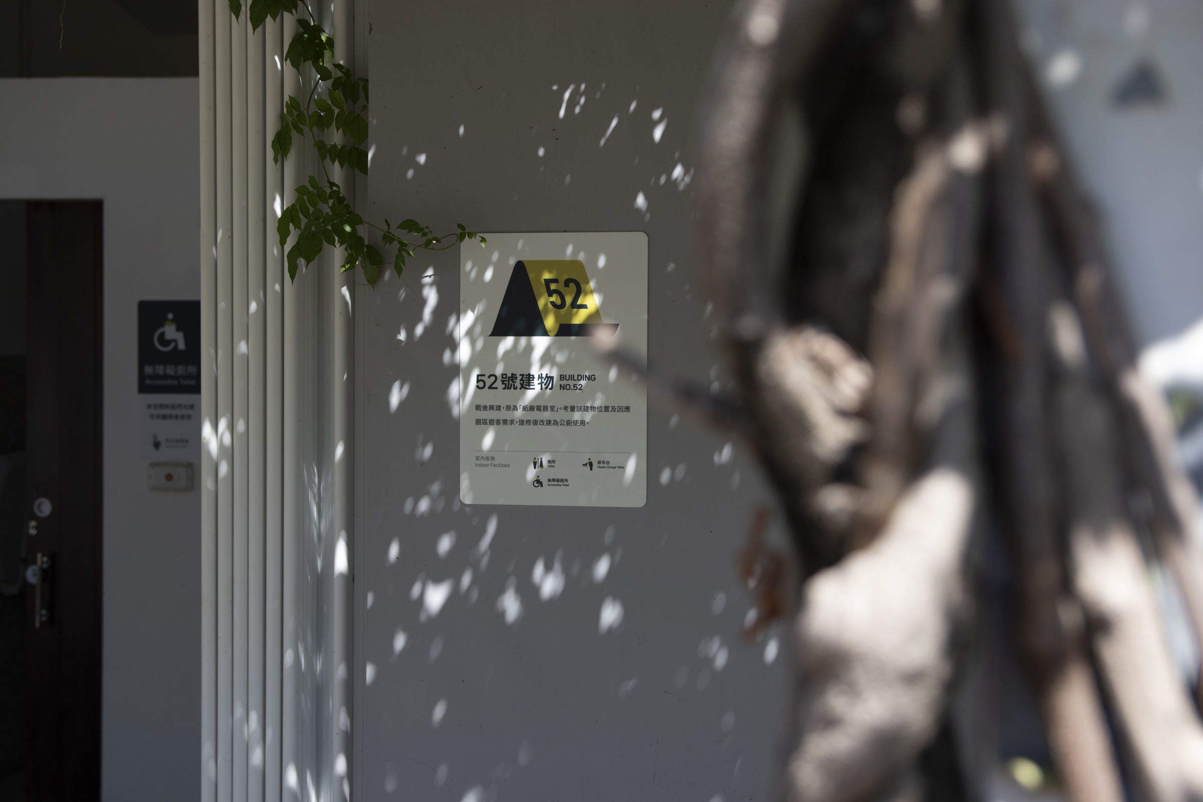
友善廁所標誌 All Gender Restrooms
延續前述觀察,我們注意到停車場末端以及園區中段後方的友善廁所使用人數較多,然而舊有指標辨識度不足、導致民眾詢問頻繁。
因此在廁所入口處接製作了較為顯著的牌面,也特例改用主色作為背景,增加環境中的識別性。
In addition, we noticed that the "All Gender Restrooms" at the end of the parking lot and the middle section of the park were frequently visited. However, the former signs were not recognizable enough. In response, more prominent signages were set up at the entrance of both restrooms, and the primary color was used as an exception to increase recognizability in the surroundings.
![]()
![]()
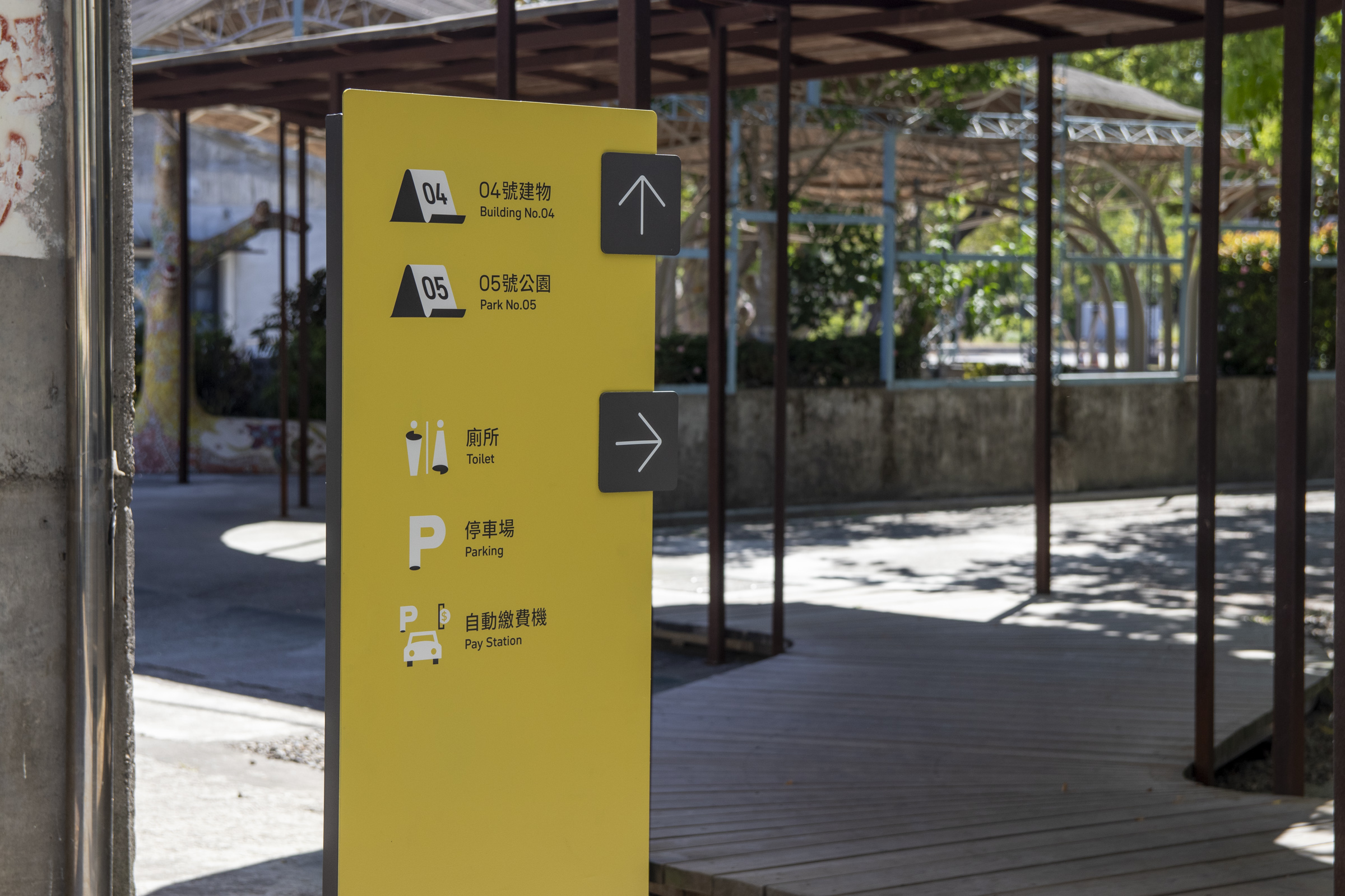
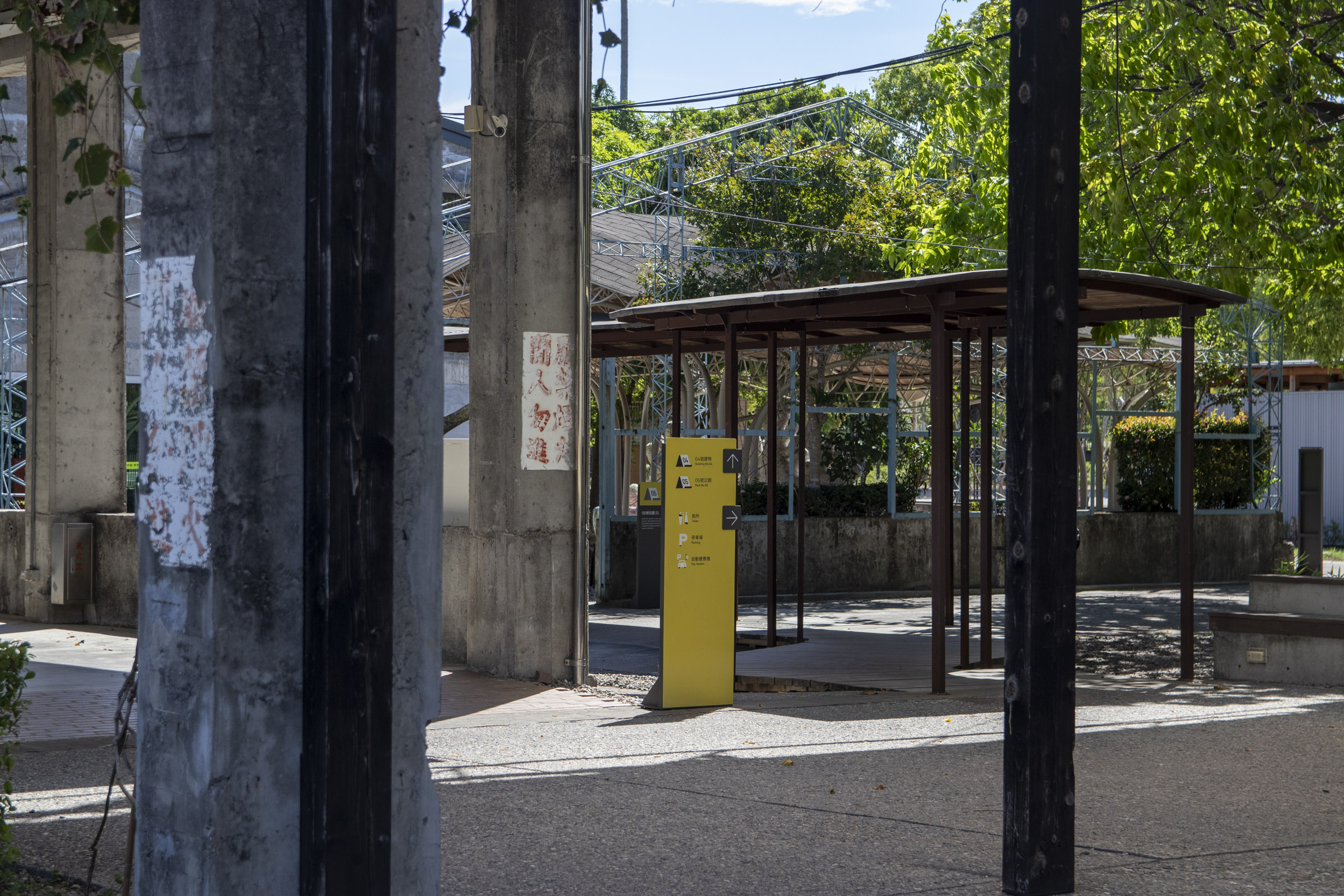
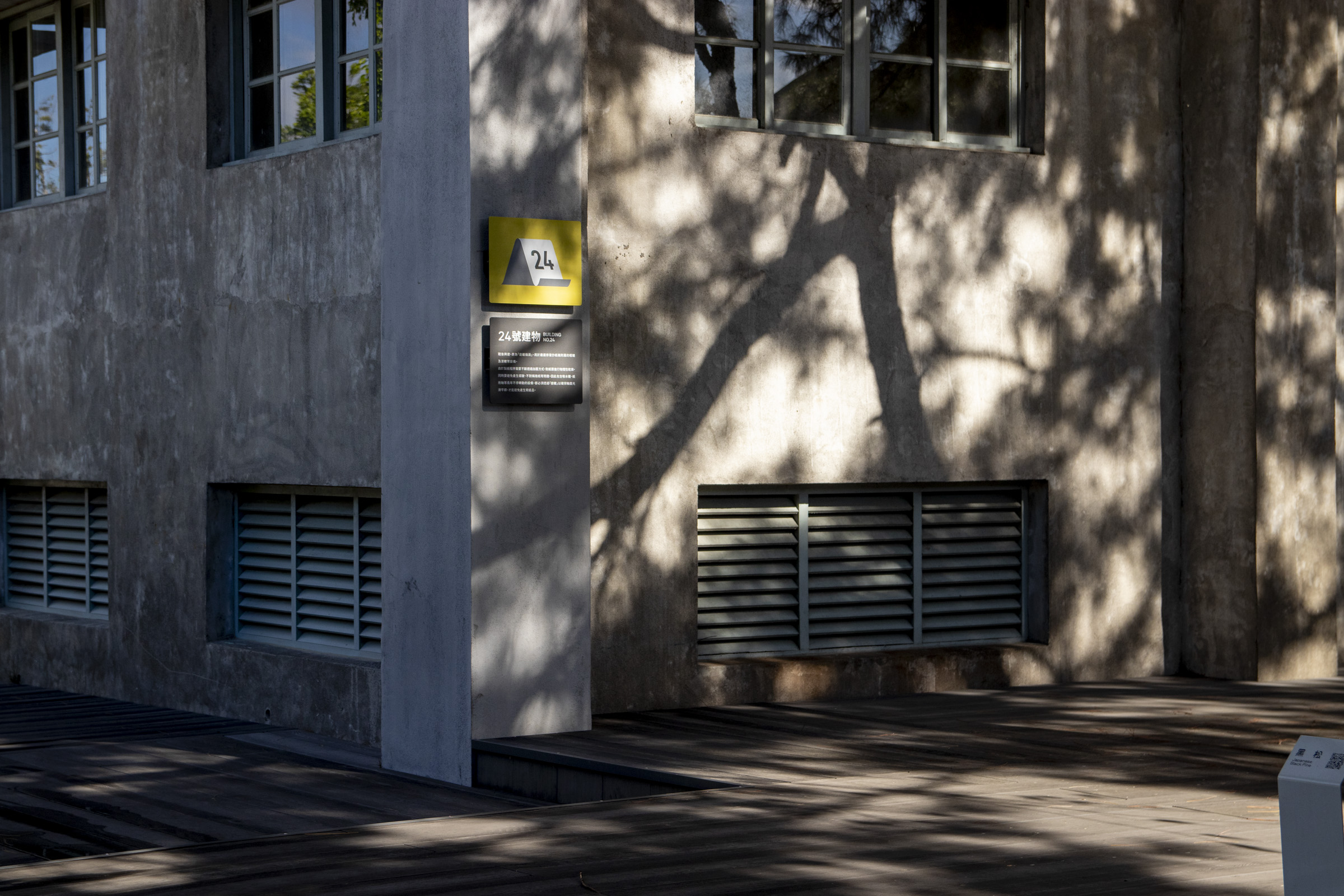
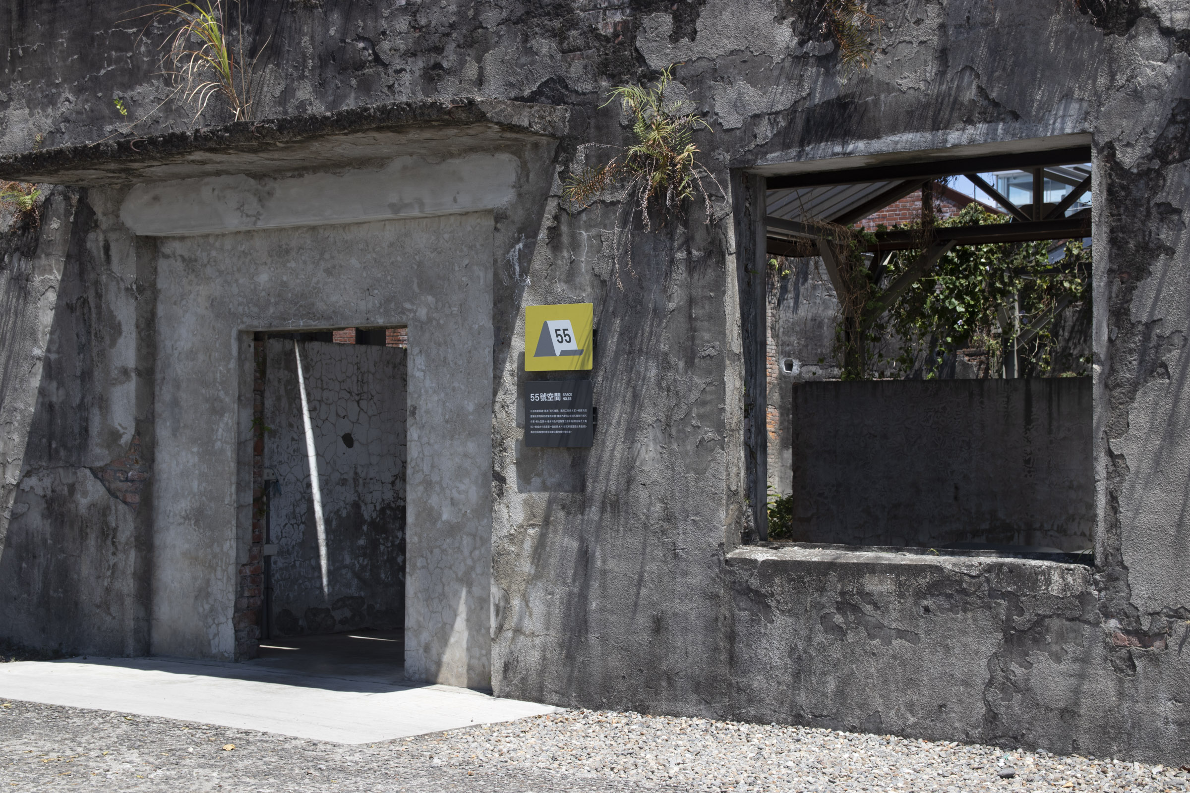
方向指標 Wayfinding (Sub Decision Point)
園區建築歷史悠久、經歷不同階段的變革,在建築周圍或空間交接處常有無法直接觀察到重要設施指標的情況。
故依照不同區域的常見需求,如地標或文化空間參觀、乃至基礎設施的導引,我們設立了承載不同方向指標的牌面,避免民眾在複雜的環境中對路線感到不確定。
The buildings in the park have undergone long history of changes at different stages. It is often difficult to directly observe important facility around corners or intersections of spaces. Thus, we set up signs with different direction indicators which lead to common needs amid various areas, such as landmark or cultural space visits, and infrastructure wayfinding. This aims to avoid visitors from feeling frustrated while on their route.
![]()
![]()
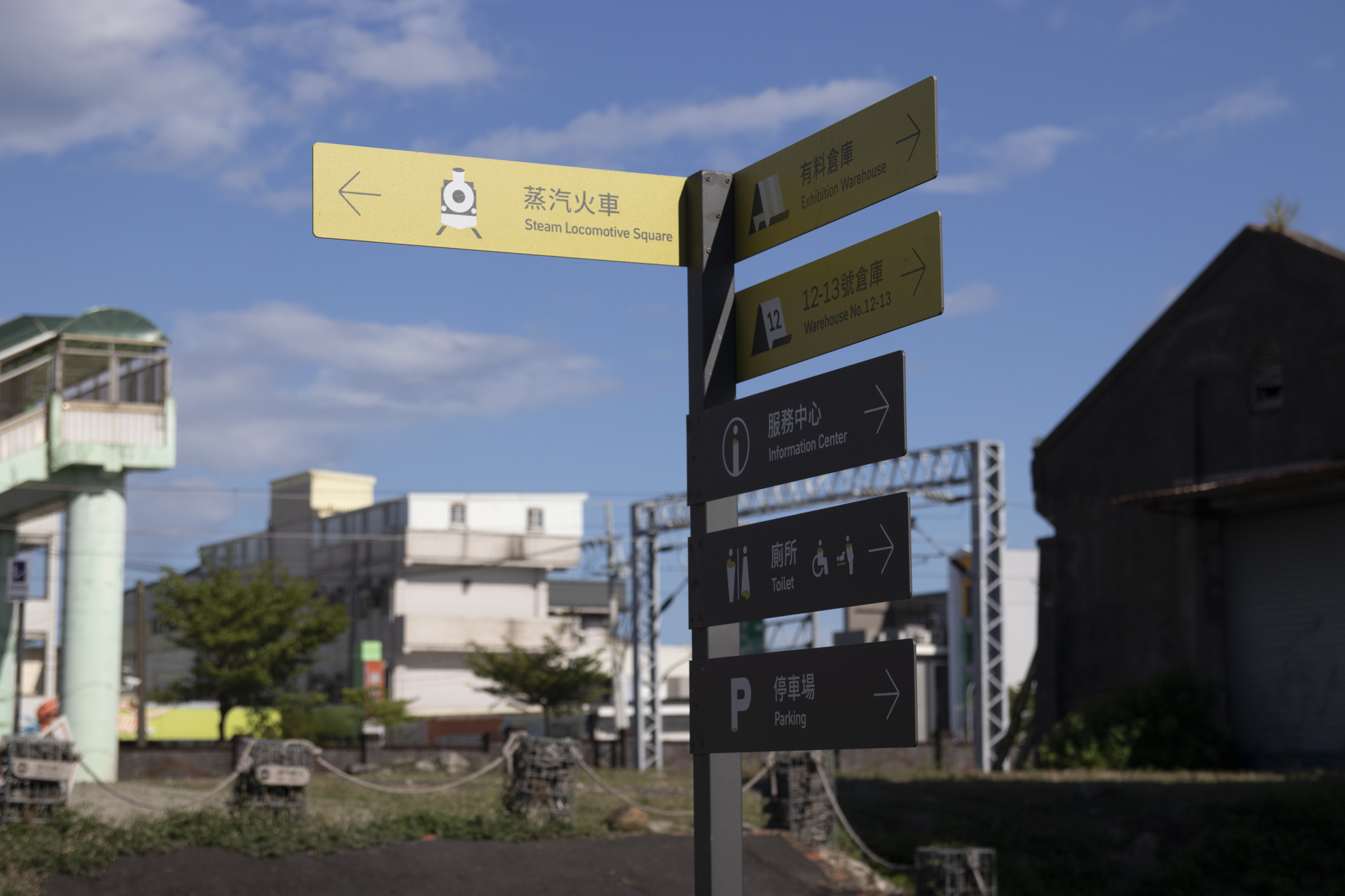
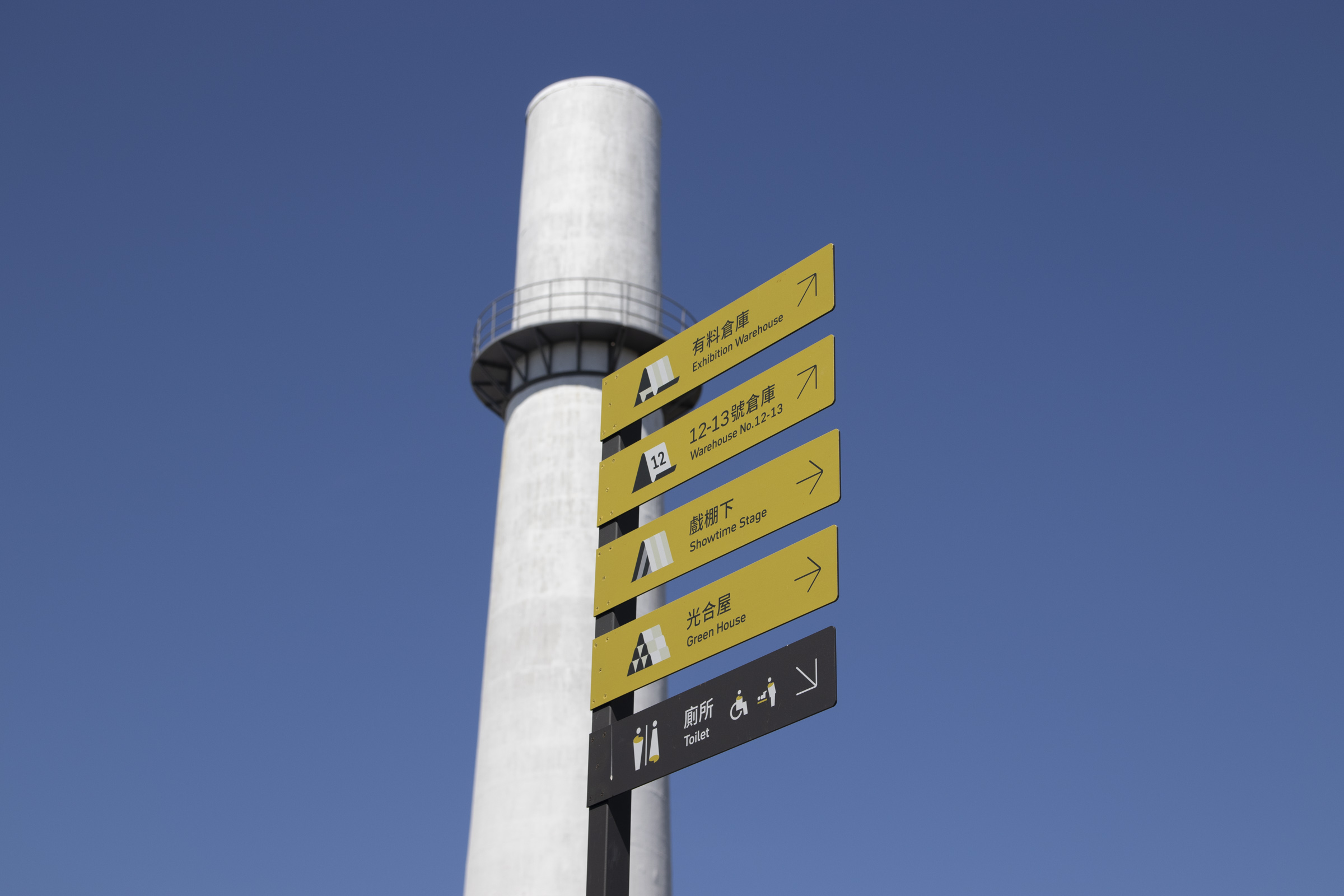
方向路牌 Wayfinding (Sub Decision Point)
園區多數通道較為狹長,在指引上也容易有前述狀況;加上園區戶外為開放空間,入園動線因人而異。
因此,我們在許多節點安裝較高的方向路牌,指引初步入園的民眾抵達一些重要地標,以接續其他指標的導引。
Most of the park's passages are long and narrow, which can easily lead to the problems above. Moreover, the park's outdoor areas are filled with open spaces, with entrance points varying from person to person. Hence, we installed directional signs at many segments, leading people entering for the first time toward major landmarks. The guidance of other wayfinding designs can be carried on in such way.
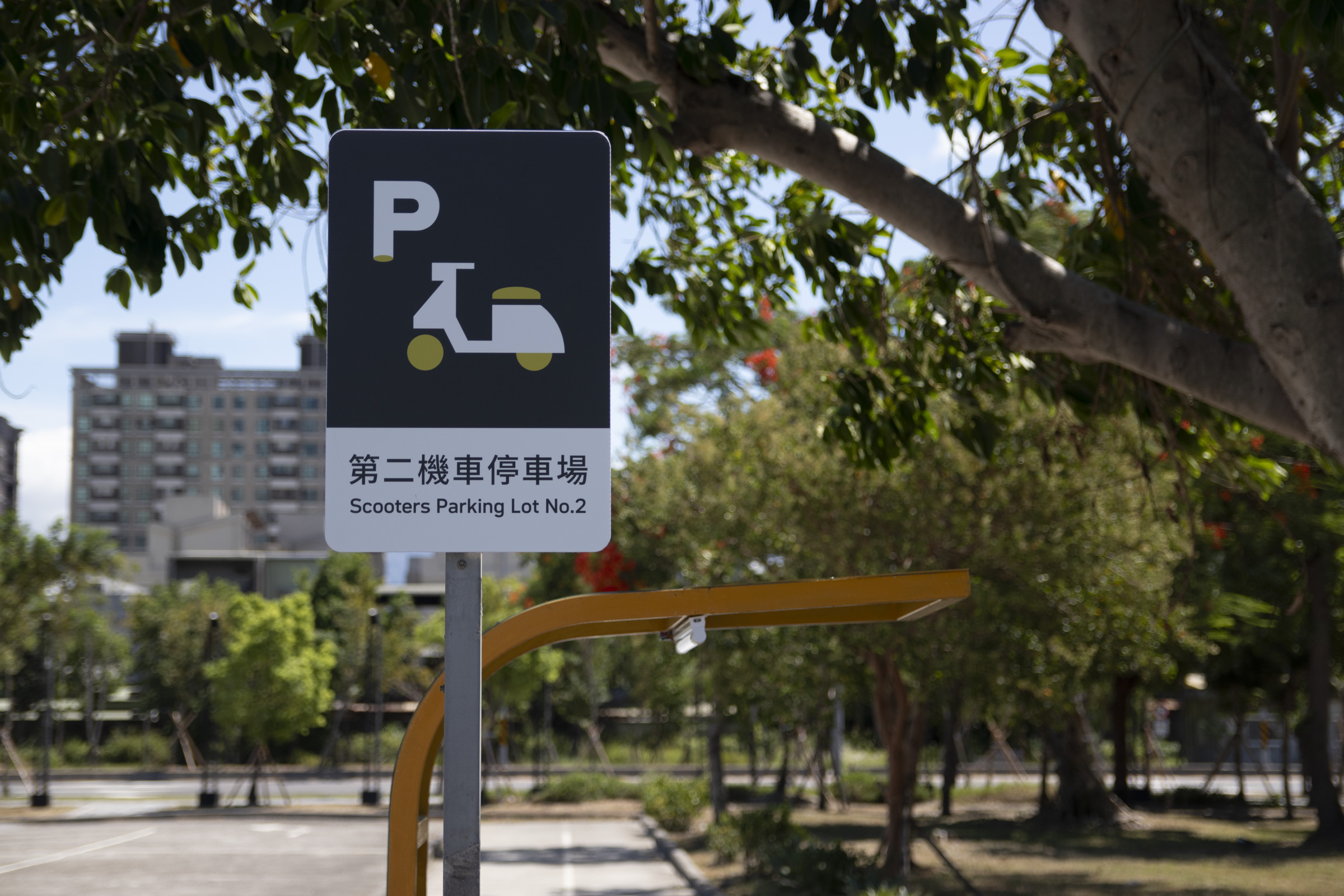
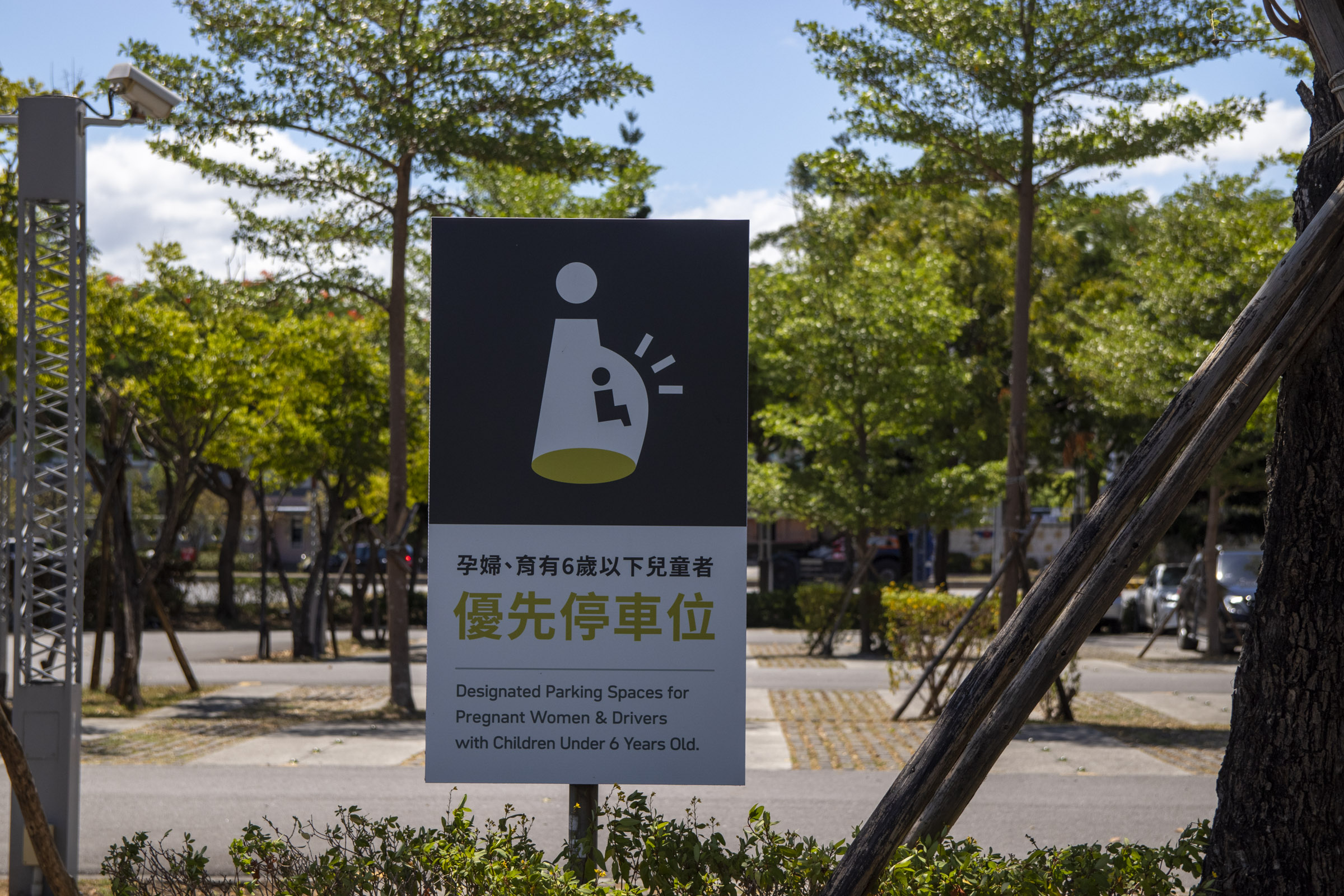
交通標示 Parking Signages
自駕為參訪民眾主要的交通方式,園區前段的停車場中依照車種、特殊群體需求等有種類繁多的規範,因此牌面的易讀性十分重要。
Driving is the main transportation for visitors. The parking lot in front of the park has a wide variety of regulations based on the types of vehicles and the needs of special groups, so the clarity among designs is critical.