(2018)
04. Remains on the Track
(2021)
(2021)
(2021)
(2021)
(2022)
(2022)
(2022)
(2022)
(2022)
(2023)
(2023)
(2024)
(2025)
(2025)
Wayfinding System Redesign of Chung Hsing Cultural & Creative Park.

The redesigned wayfinding system for “CHCC Park” returns its focus to the site’s historical context of "former paper factory", while considering the present scenery of industrial relics.
By incorporating the imagery of paper being bent or folded, a unique visual vocabulary was established to present a distinct identity suited for navigation purposes and future expansions.
# WAYFINDING SYSTEM DESIGN
CLIENT/ Chung Hsing Cultural & Creative Park, Cultural Affairs Bureau Yilan County
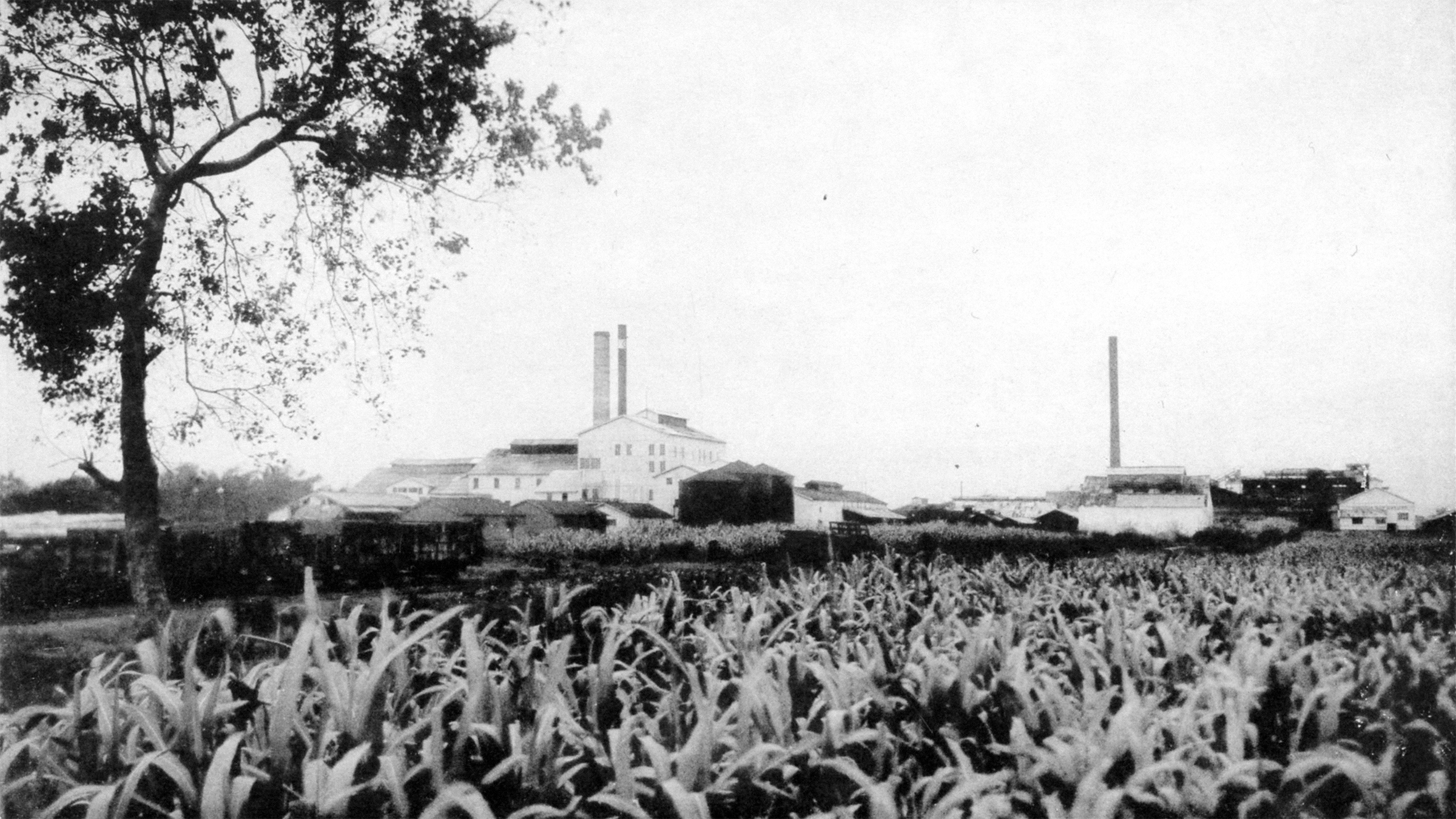
The predecessor of the Chung Hsing Cultural and Creative Park can be traced back to the Taiwan Industrial Corporation, which was established in 1935. It was later reorganized into a state-owned paper factory.
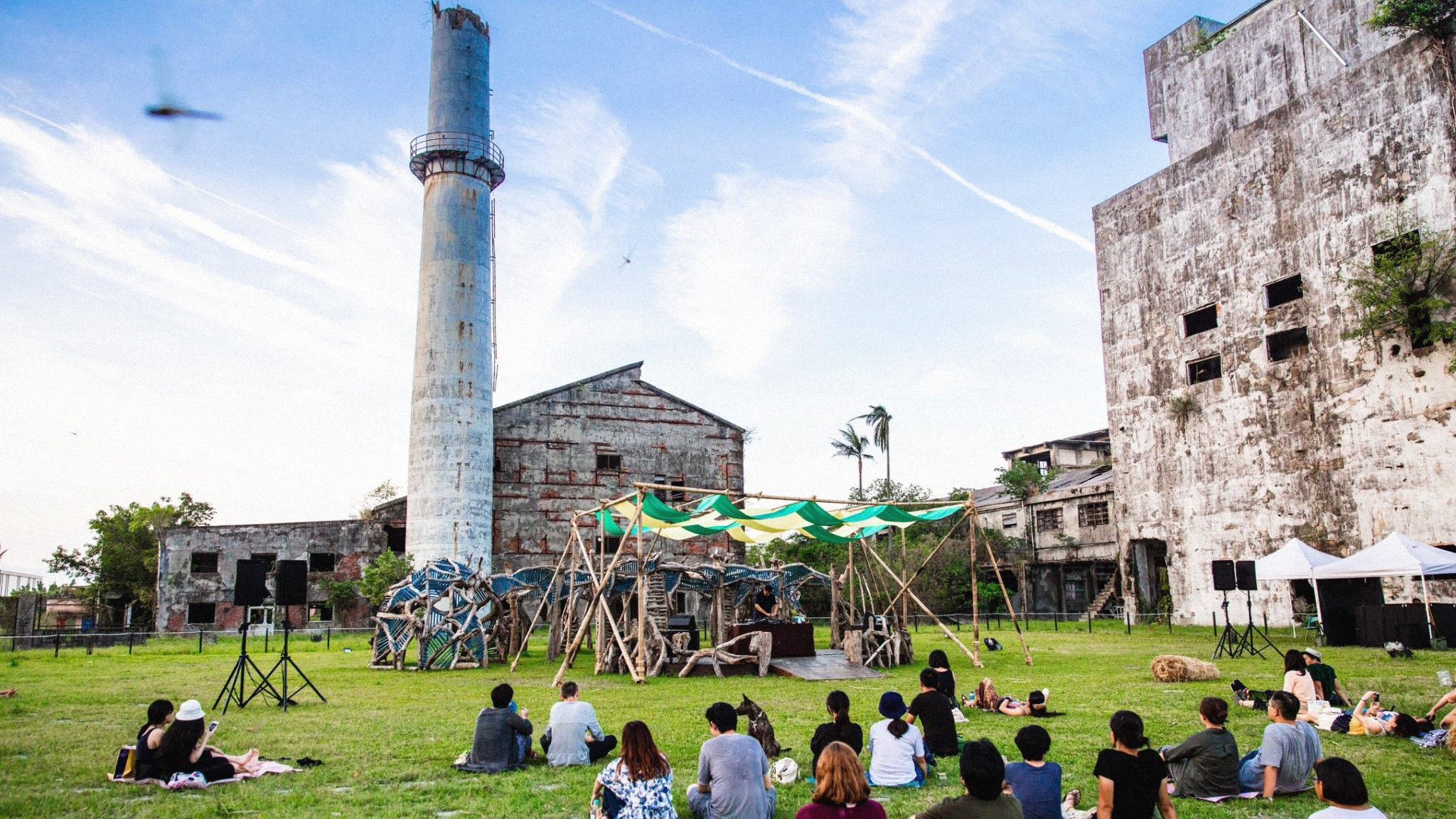
In 2013, the Yilan County Government initiated the preservation and revitalization of industrial heritage within the park. Since then, it has gradually developed into a space for cultivating and operating local cultural and creative applications.


However, after years of operation, no complete wayfinding system was established among the park. Designs with mixed styles had been implemented between different stages of construction, and as operating policies of some facilities had changed, a certain proportion of signages no longer meet actual needs.
Thus in 2023, the park commissioned us to carry out a one-year work plan, aiming to update the overall wayfinding system.
System Update Planning
We started with a field visit, collected opinions from visitors, and organized meetings with businesses.
Space studies were also conducted, laying out visitor flows and decision points, gathering all information needed for our design process.
Wayfinding Updates
Given that the park has a vast space and facilities are scattered over long distances, ensuring the wayfinding system overlaps with the habitual routes of visitors and thus achieves a guiding effect is an crucial point in our planning.


*Rotate your mobile device to have a better grasp of the slider's map.
By introducing "decision points" and creating a variety of levels in our system, we are able to get a better grasp of where our design placements should be, and what key information they must carry.

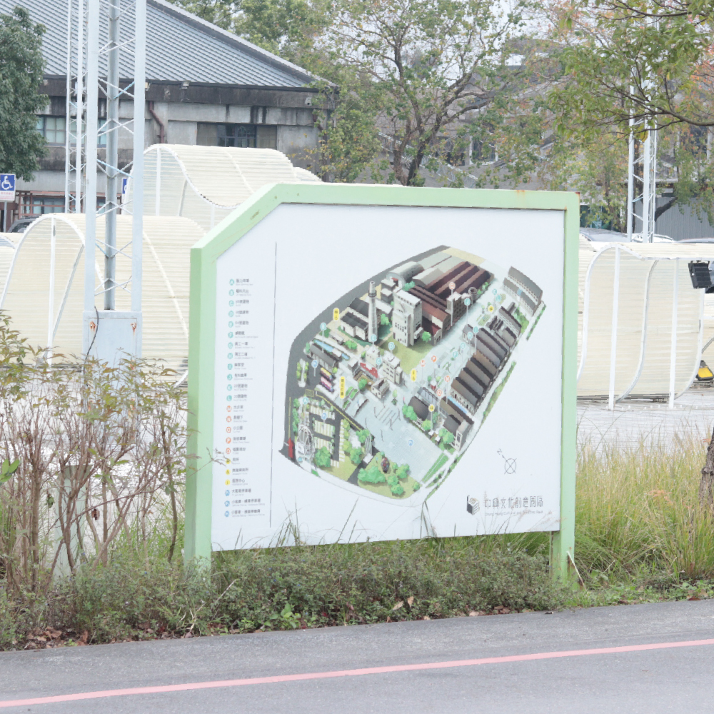
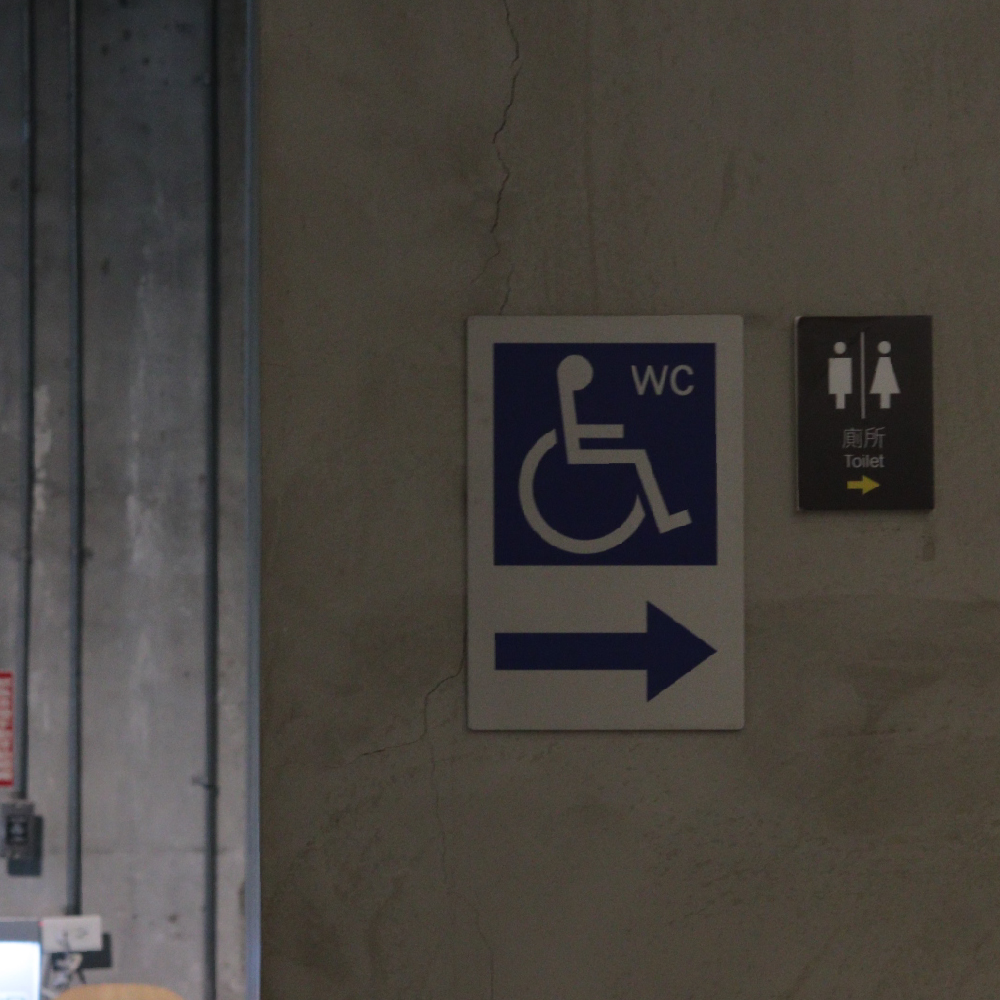
Locations where visitors most often need to plan their routes after entering are slected as main decision points, including the front entrance, the center of the square, and the toilets next to the parking lot.
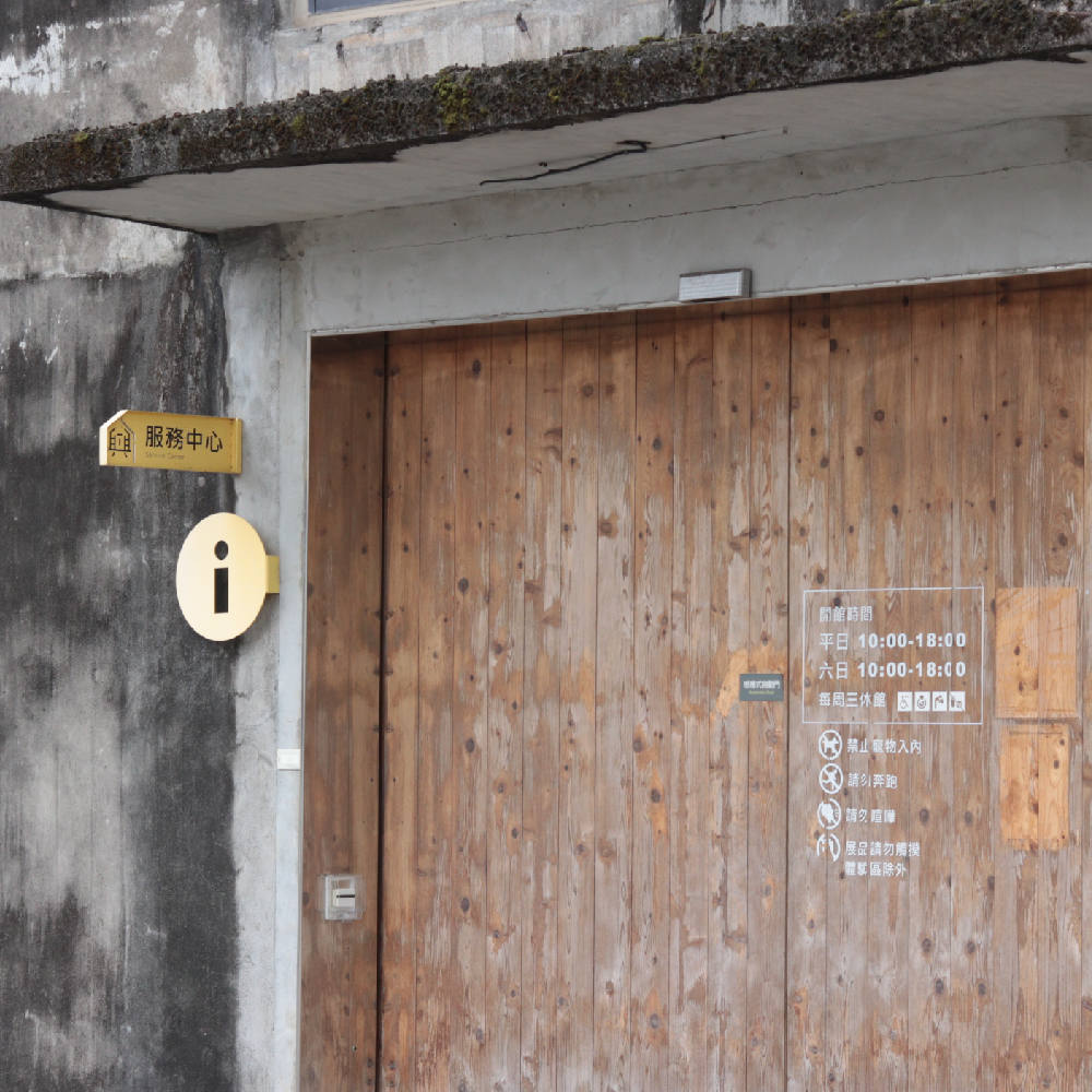
The signage is presented with an overall map, and the design changes according to the surrounding environment.
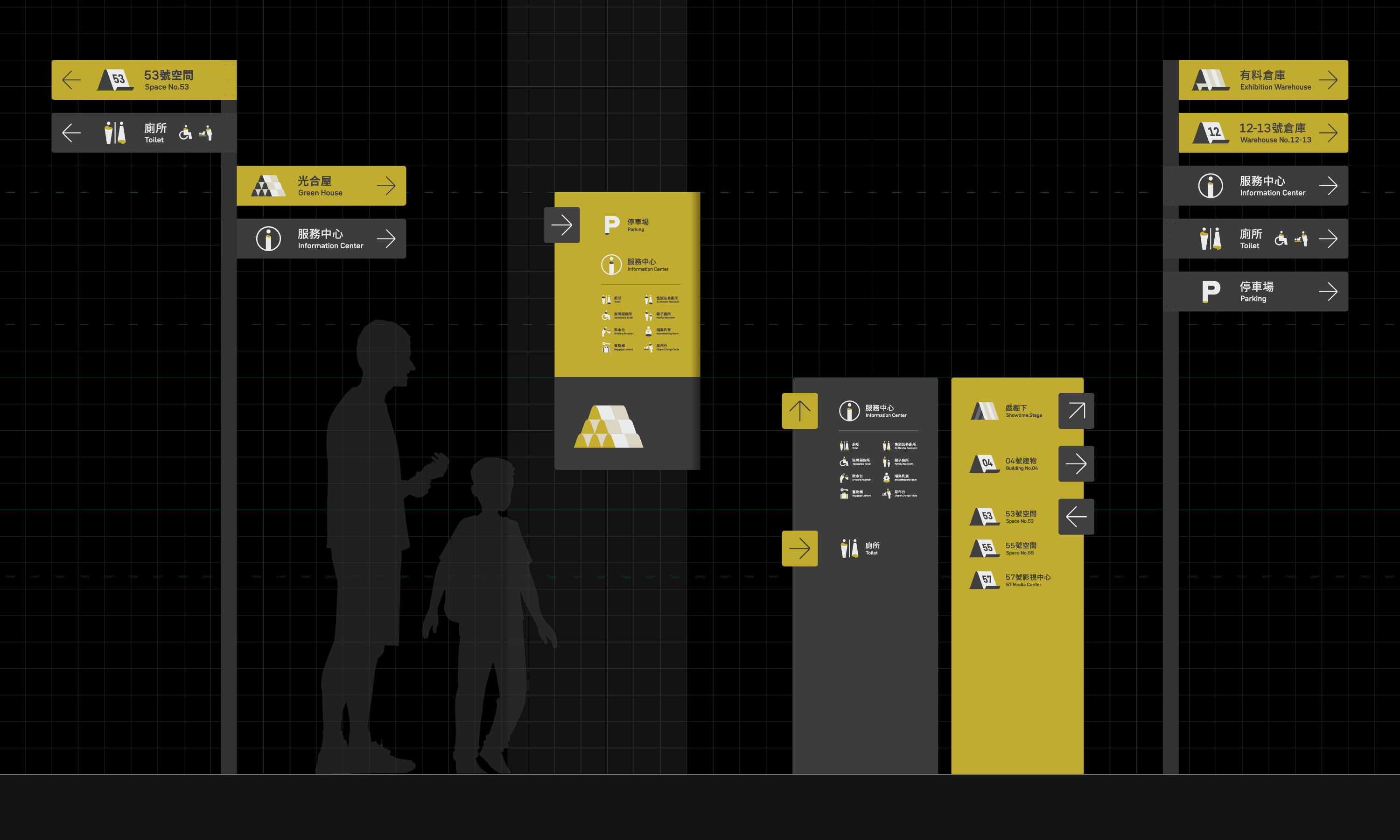
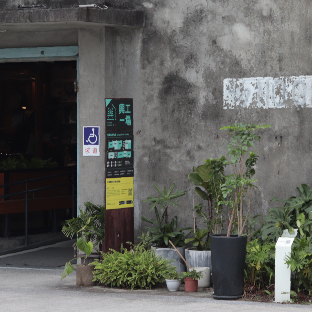
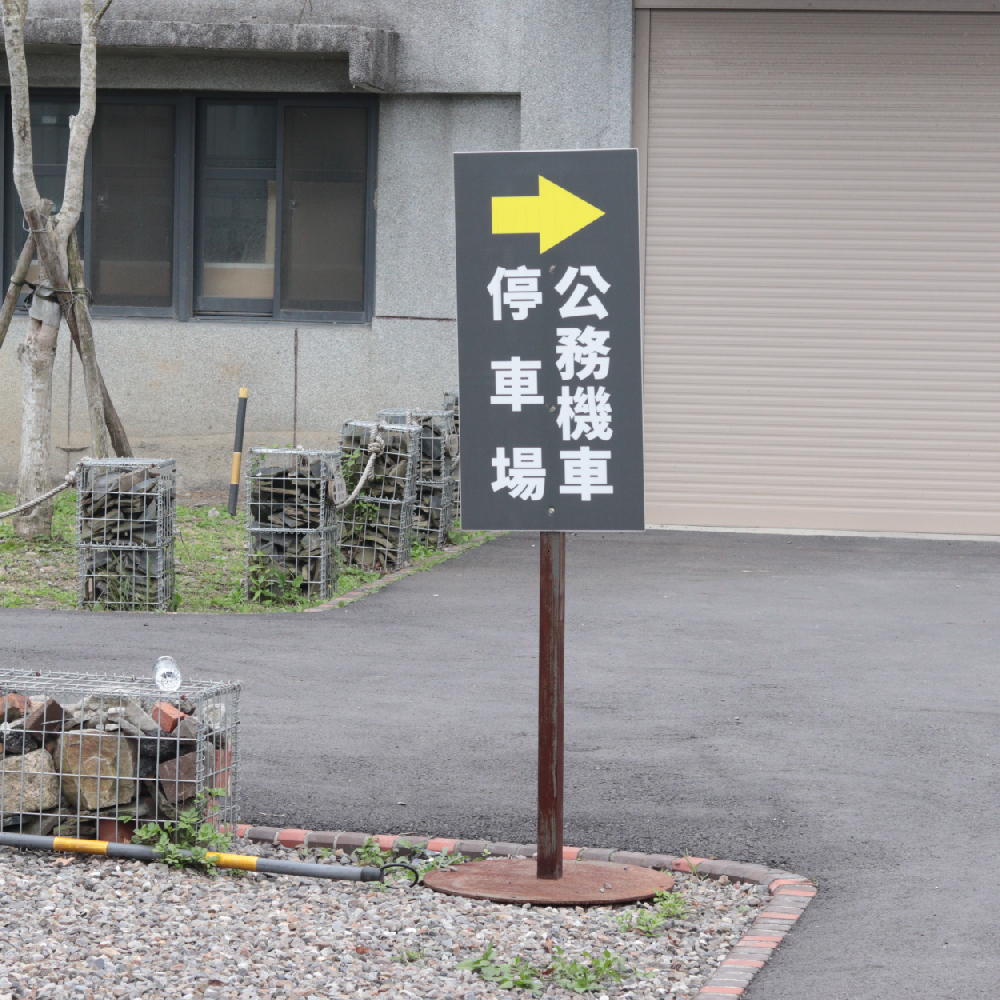
Sub decision points cover hot spots with high demand for guidance of specific facilities, as well as expected visitor routes for flow maintainence.
The signages focus on the wayfinding toward specific locations, mainly presenting directional signs or guidance on surrounding facilities, and occasionally combined with space introductions.
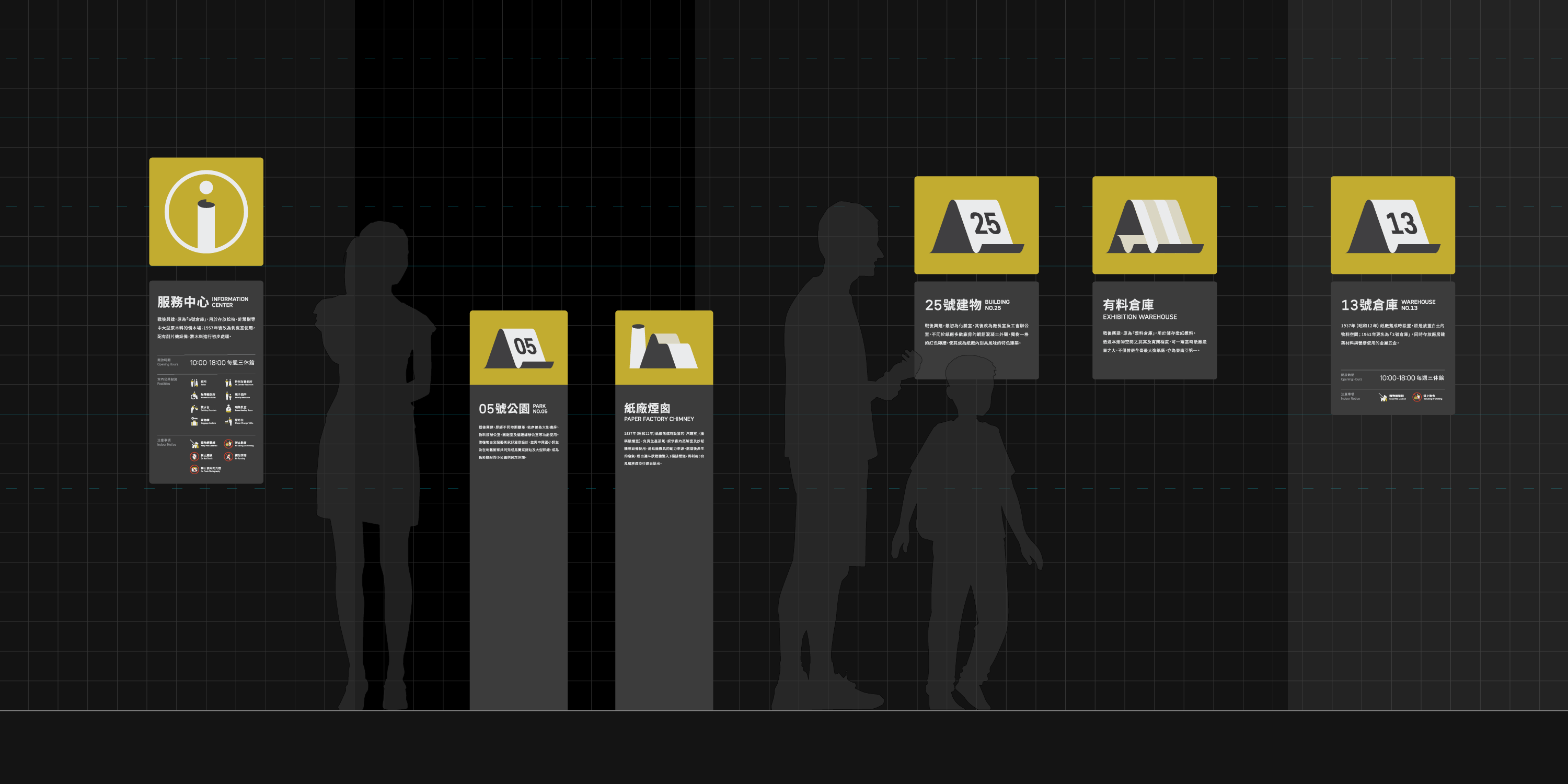
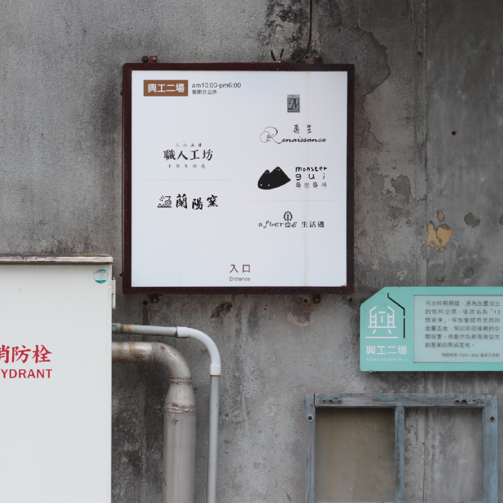
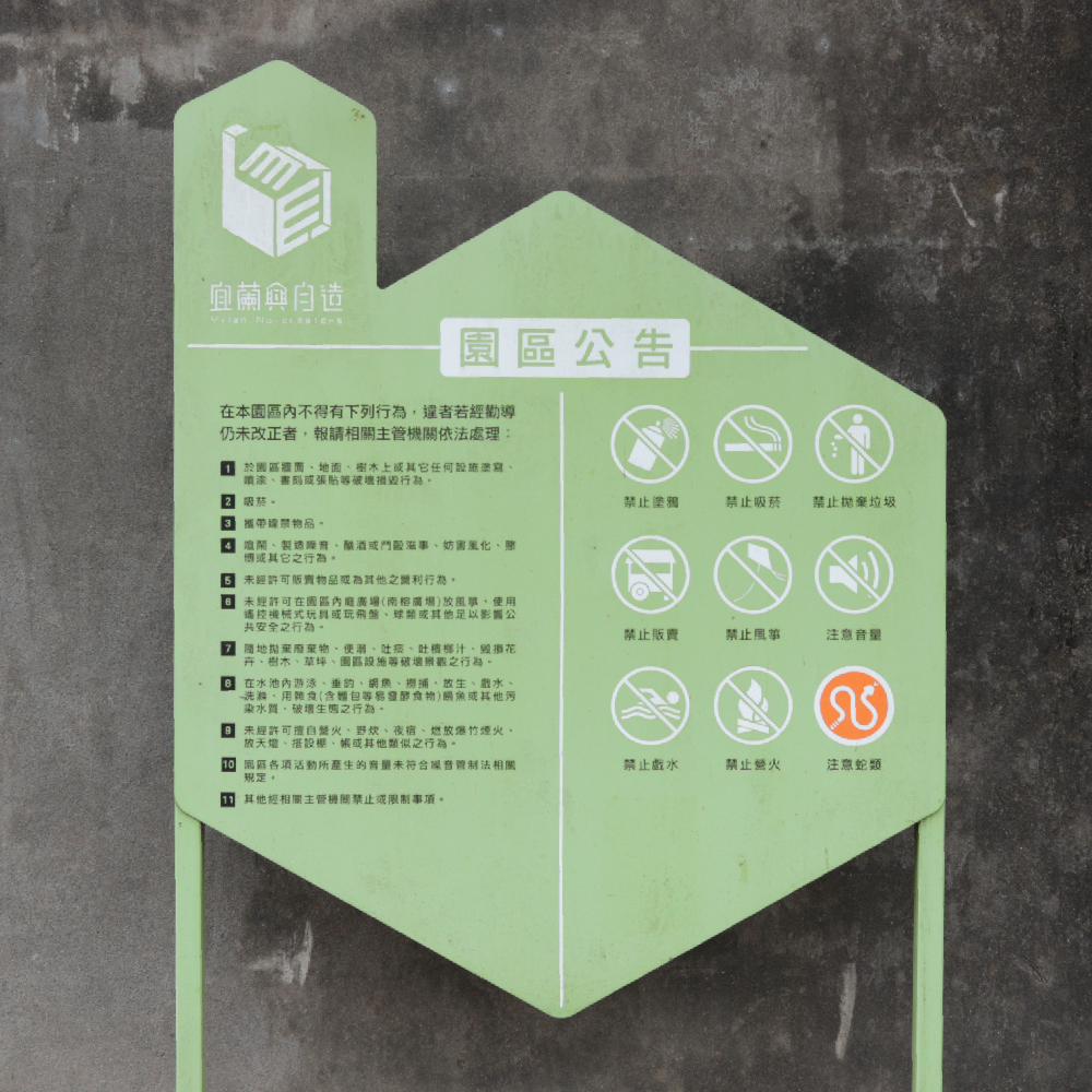
In line with the updated system and future developments, the main facilities and open spaces are all equipped with guidance or introduction signs in our project.
Specific buildings with high traffic also supplement overviews to enhance the overall integrity of the park's wayfinding experience.
Layout Settings
Different levels presented among the layout of our design is also one of the crucial factors.
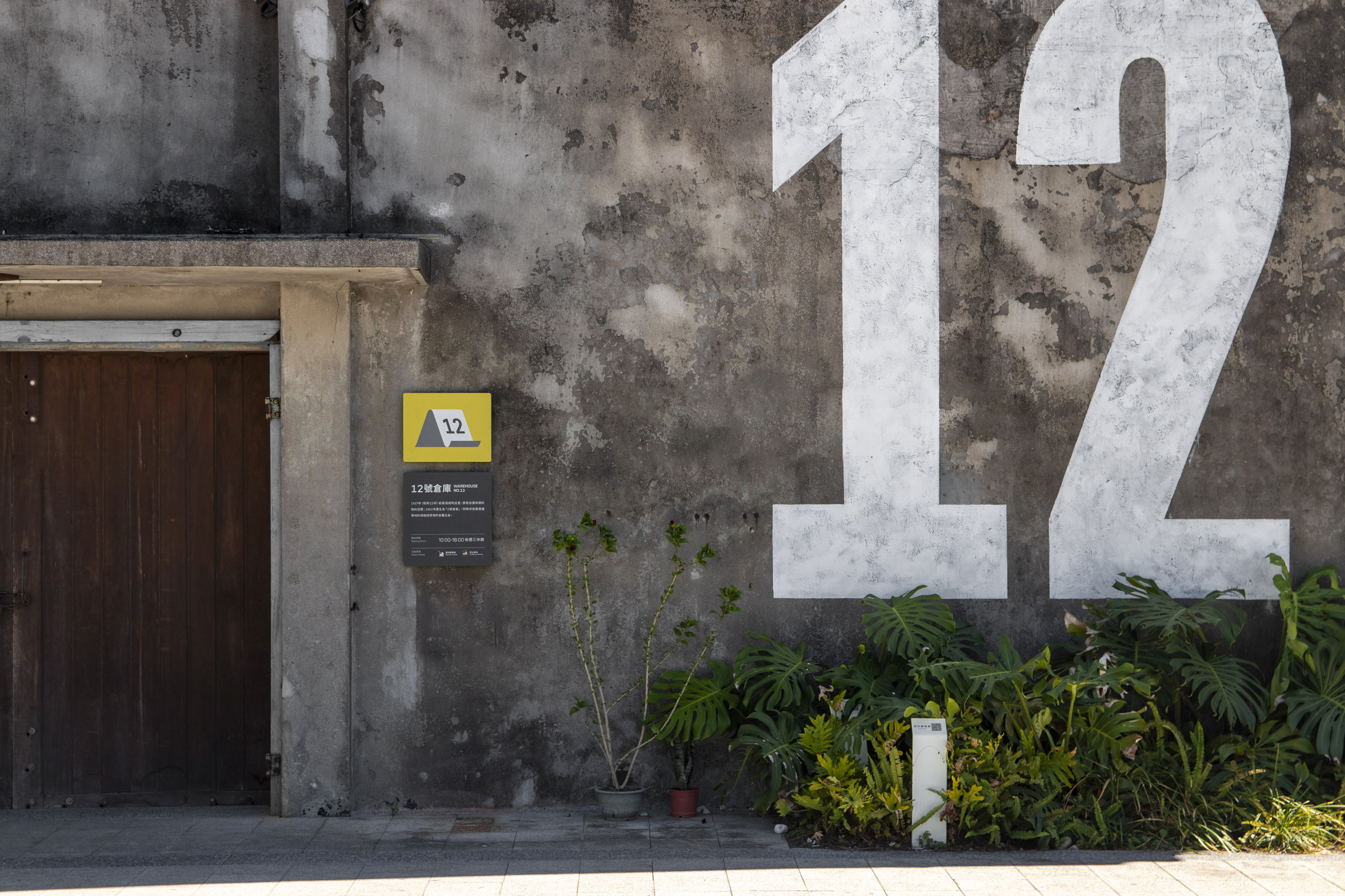
We created various forms of wafinding elements from large to smaller scales, from numeric titles on the walls, numbered labels in pictograms, to basic signage layout.
Efforts were made to maintaining the system's identity and clarity while coordinating with the general public's reading habits.
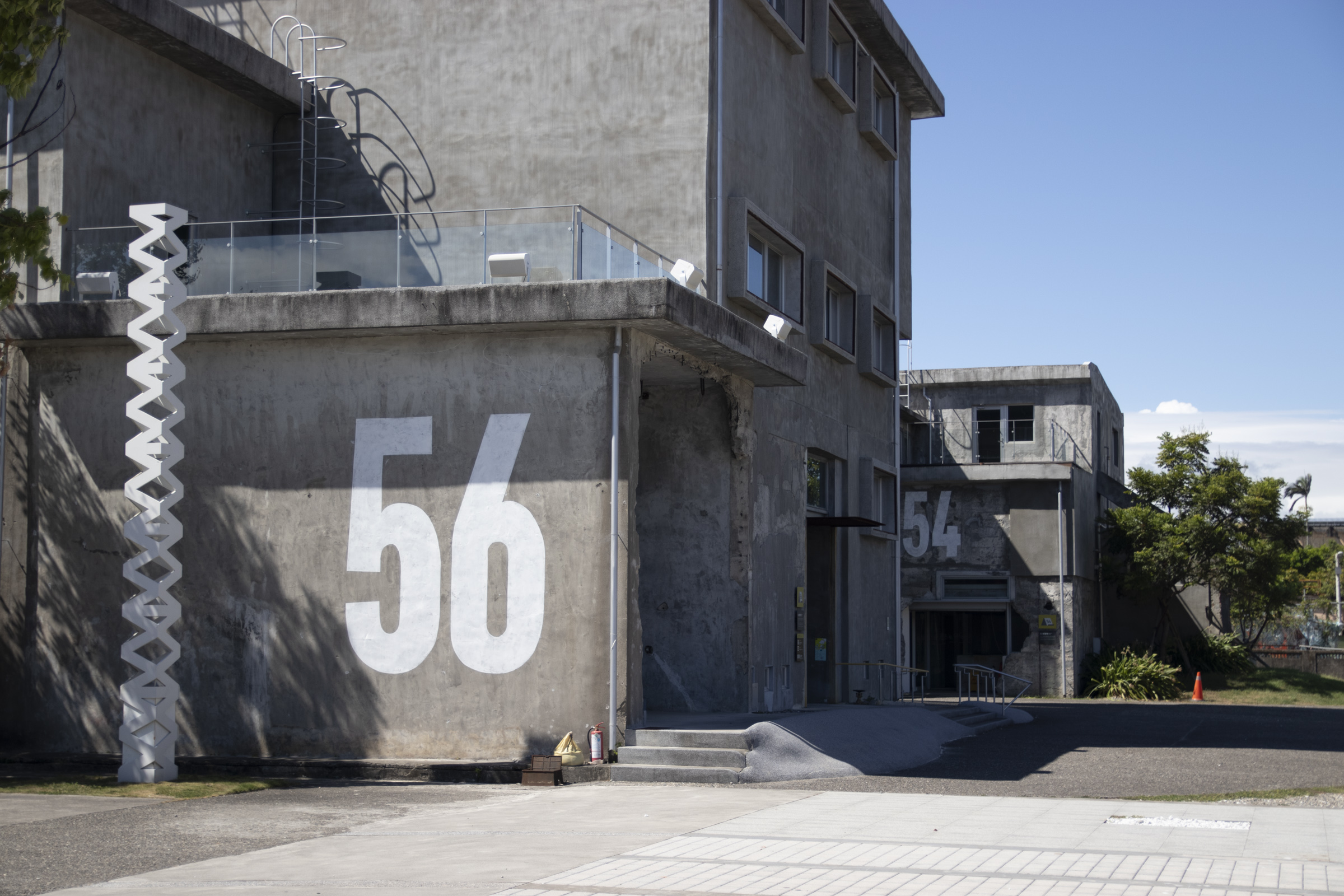

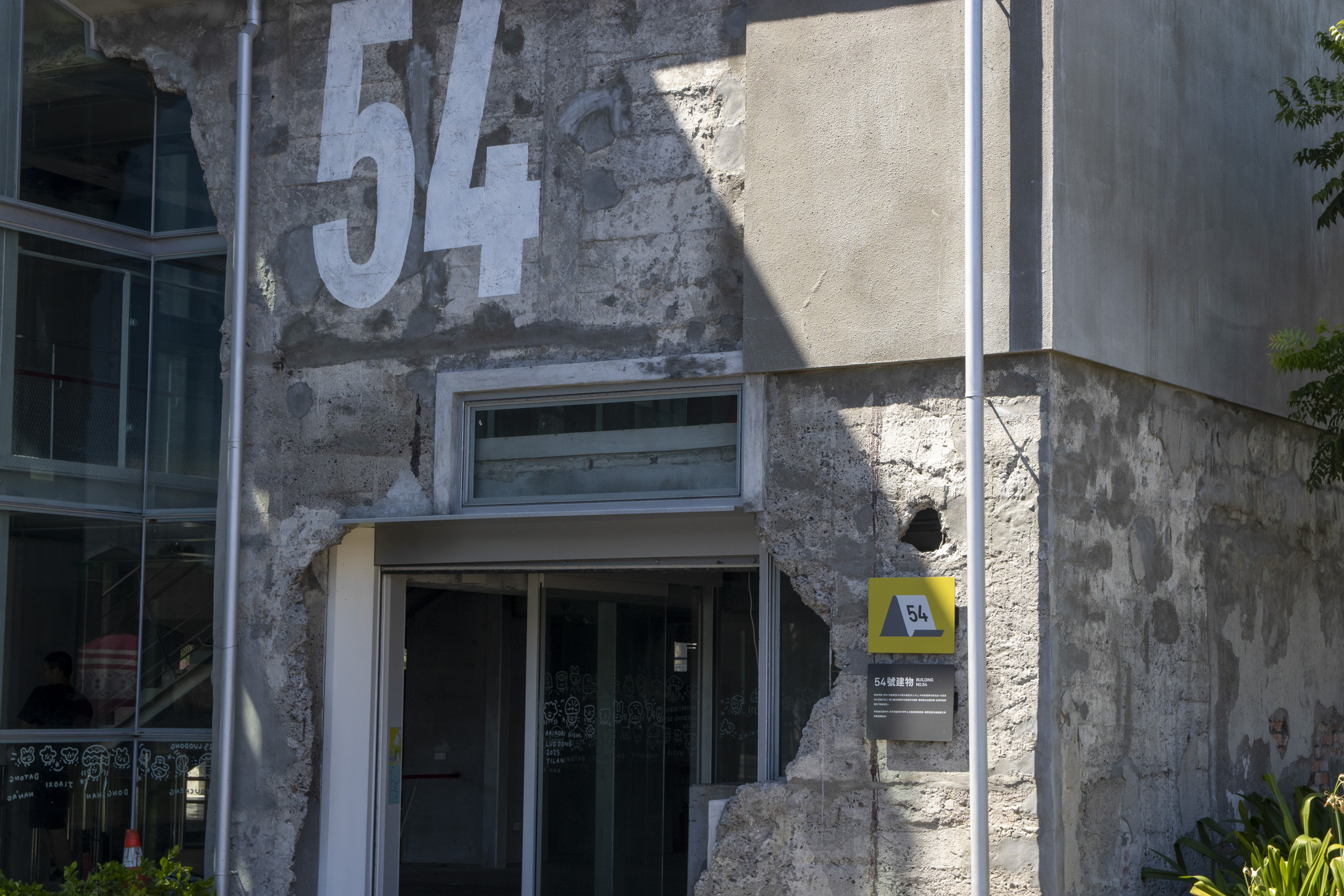
By painting large-scale numeric titles on certain buildings that share similar structures and coherent locations, we improved long-distance clarity and strengthened their past industrial context.